Topographic map of Venusian north polar region
Numéro d’image : 11881700
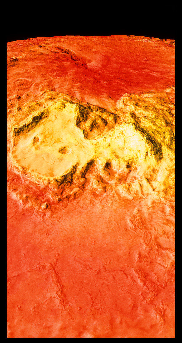
| Colour-coded topographic map of the region surrounding Venus' north pole. Bright yellow areas are the highest & dark orange areas the lowest. The yellow region is Ishtar Terra and contains Lakshmi Planum (left) and the Maxwell Montes (right),the highest mountains on Venus. The two crater-like depressions in Lakshmi Planum are the calderas of two volcanoes,Colette (left) & Sacajawea (right). The map was compiled using data from the Soviet Venera 15 & 16 spacecraft,the American Pioneer Venus spacecraft and the Arecibo radio telescope in Puerto Rico | |
| Licence : | Droits gérés |
| Crédit: | Science Photo Library / NASA / US Geological Survey |
| Taille de l’image : | 3071 px × 5787 px |
| Model Release : | Non requis |
| Property Release : | Non requis |
| Restrictions : | - |
Prix pour cette image À partir de 45 €
Produit vendu
(Calendrier, Carte postale, Carte de vœux, Impression sur textile, Packaging etc)
À partir de 45 €
Usage commercial
(Affichage, Annonce presse, Annonce TV, Carte, Digital - hors rés. sociaux, Digital - rés. sociaux etc)
À partir de 45 €
Éditorial
(Digital, Journal, Livre, Livre pratique, Magazine, Télévision etc)
À partir de 60 €
Usage non-commercial
(Digital - hors rés. sociaux, Digital - rés. sociaux etc)
À partir de 120 €