Temperature map of Mercury from radio observations
Numéro d’image : 11881614
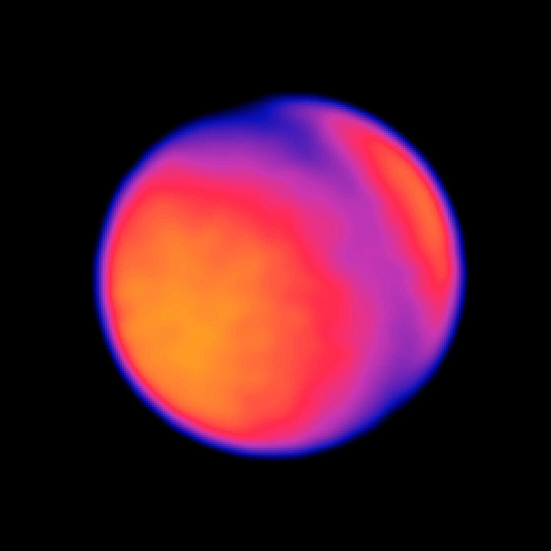
| Mercury temperature map. Coloured radio image of the surface of the planet Mercury,showing the range of temperatures across its surface. This image was obtained by the VLA (Very Large Array) radio observatory at a 2 centimetre wavelength. The hotter regions are represented by the yellow colour. Mercury has two hot poles on its equator,produced by the intense heat of the nearby Sun. The far pole is hidden,but may be deduced by the heating at the edge of the disc at lower right | |
| Licence : | Droits gérés |
| Crédit: | Science Photo Library / NSF / AUI / NRAO / M. LEDLOW ET AL |
| Taille de l’image : | 1743 px × 1743 px |
| Model Release : | Non requis |
| Property Release : | Non requis |
| Restrictions : |
|
Prix pour cette image À partir de 45 €
Produit vendu
(Calendrier, Carte postale, Carte de vœux, Impression sur textile, Packaging etc)
À partir de 45 €
Usage commercial
(Affichage, Annonce presse, Annonce TV, Carte, Digital - hors rés. sociaux, Digital - rés. sociaux etc)
À partir de 45 €
Éditorial
(Digital, Journal, Livre, Livre pratique, Magazine, Télévision etc)
À partir de 60 €
Usage non-commercial
(Digital - hors rés. sociaux, Digital - rés. sociaux etc)
À partir de 120 €