Temperature map of Mercury made from radio observ
Numéro d’image : 11881607
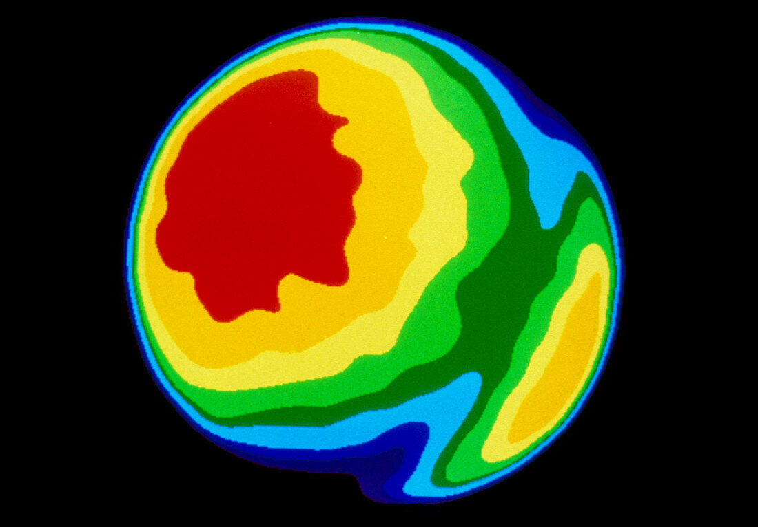
| False-colour temperature map of Mercury,made from radio observations at the Very Large Array (VLA) radio telescope,New Mexico USA. The colours show temperature just below the planet's surface,red indicating the highest temperature of 400 Kelvin. The map clearly shows one of the temperature 'poles' on Mercury's equator (left),caused by the intense heating of the surface by the nearby Sun. This is accentuated by Mercury's spin-orbit coupling,in which it rotates only three times in the course of two solar orbits. The far 'pole' is hidden,but may be deduced by the heating seen at the right edge of the disc. The observations for this image were made at 2cm wavelength | |
| Licence : | Droits gérés |
| Crédit: | Science Photo Library / Ledlow, Dr. Michael J. |
| Taille de l’image : | 4467 px × 3111 px |
| Model Release : | Non requis |
| Property Release : | Non requis |
| Restrictions : | - |
Prix pour cette image À partir de 45 €
Produit vendu
(Calendrier, Carte postale, Carte de vœux, Impression sur textile, Packaging etc)
À partir de 45 €
Usage commercial
(Affichage, Annonce presse, Annonce TV, Carte, Digital - hors rés. sociaux, Digital - rés. sociaux etc)
À partir de 45 €
Éditorial
(Digital, Journal, Livre, Livre pratique, Magazine, Télévision etc)
À partir de 60 €
Usage non-commercial
(Digital - hors rés. sociaux, Digital - rés. sociaux etc)
À partir de 120 €