Blind person with GPS navigation system
Numéro d’image : 11846213
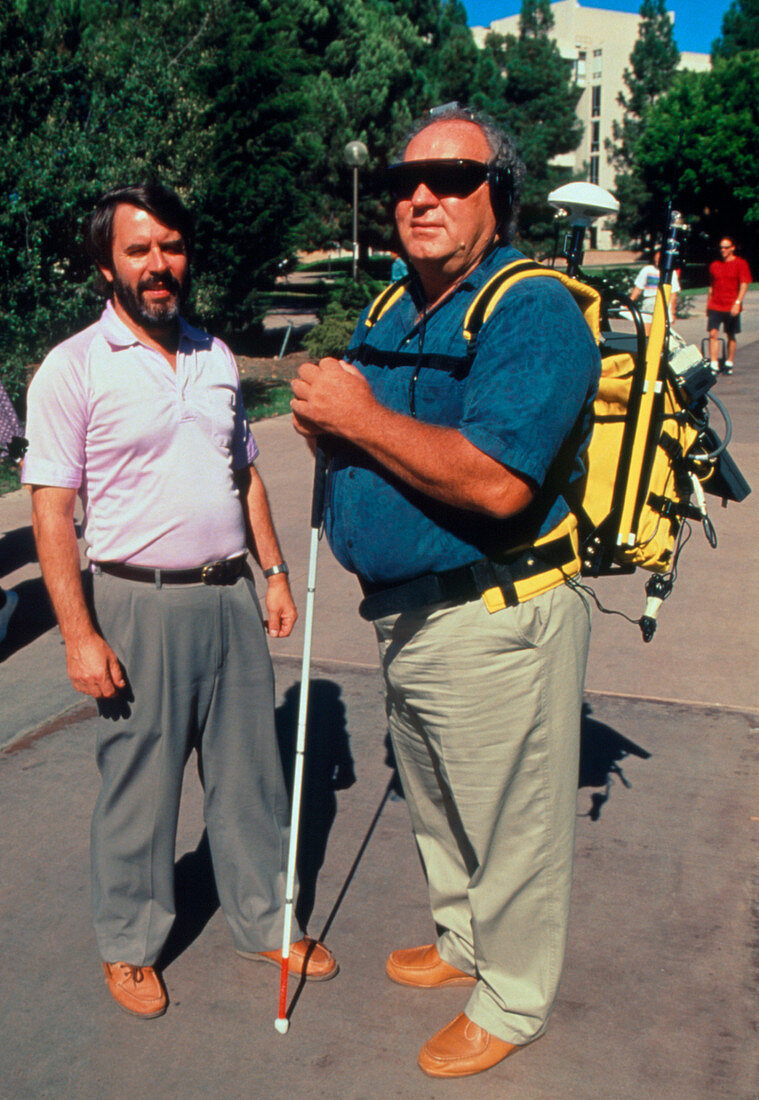
| Navigation aid for the blind. Blind man Reginald Golledge (right) and researcher Jack Loomis with the Personal Guidance System,an electronic navigation aid for blind people. The position of the user is determined by a GPS satellite receiver,and the direction in which they are facing by an electronic compass. These data are compared with a digital map in a computer,which calculates the position of landmarks relative to the user and synthesizes a word (eg 'Library') for each. These are fed into stereo earphones so the user can hear them coming from the correct relative locations. This system was developed at the University of California at Santa Barbara | |
| Licence : | Droits gérés |
| Crédit: | Science Photo Library / Morgan, Hank |
| Taille de l’image : | 2499 px × 3620 px |
| Model Release : | Le droit n'est pas encore disponible. Merci de nous contacter avant utilisation. |
| Property Release : | Non requis |
| Restrictions : |
|
Prix pour cette image À partir de 45 €
Produit vendu
(Calendrier, Carte postale, Carte de vœux, Impression sur textile, Packaging etc)
À partir de 45 €
Usage commercial
(Affichage, Annonce presse, Annonce TV, Carte, Digital - hors rés. sociaux, Digital - rés. sociaux etc)
À partir de 45 €
Éditorial
(Digital, Journal, Livre, Livre pratique, Magazine, Télévision etc)
À partir de 60 €
Usage non-commercial
(Digital - hors rés. sociaux, Digital - rés. sociaux etc)
À partir de 120 €