Compass and dividers
Numéro d’image : 11826789
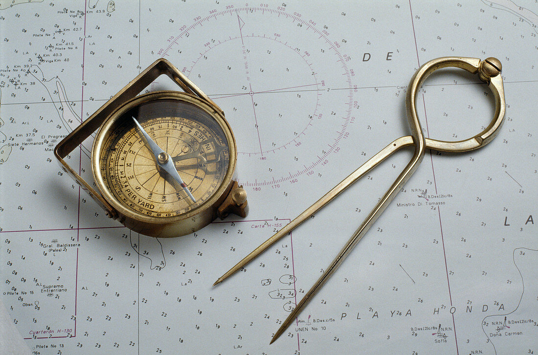
| Compass and dividers on a map. These two devices are used in simple navigation. The compass is used to find North. The needle inside is magnetized and swings freely to point north-south. The end of the needle marked in red is the north-pointing end. The dial is marked with degrees,and the adjustable pointer is pointing to the north-west. This pointer is used to follow the path indicated by the map. The set of dividers is adjusted to span the distance between two points on the map,allowing the map's scale to be used to calculate the real distance between these two points | |
| Licence : | Droits gérés |
| Crédit: | Science Photo Library / Percival, Steve |
| Taille de l’image : | 5175 px × 3416 px |
| Model Release : | Non requis |
| Property Release : | Non requis |
| Restrictions : | - |
Prix pour cette image À partir de 45 €
Produit vendu
(Calendrier, Carte postale, Carte de vœux, Impression sur textile, Packaging etc)
À partir de 45 €
Usage commercial
(Affichage, Annonce presse, Annonce TV, Carte, Digital - hors rés. sociaux, Digital - rés. sociaux etc)
À partir de 45 €
Éditorial
(Digital, Journal, Livre, Livre pratique, Magazine, Télévision etc)
À partir de 60 €
Usage non-commercial
(Digital - hors rés. sociaux, Digital - rés. sociaux etc)
À partir de 120 €
Mots clés
- appareil,
- appareils,
- boussole,
- carte,
- cartographie,
- course d'orientation,
- direction,
- dispositif,
- dispositifs,
- distance,
- équipement,
- géographie,
- géographique,
- histoire,
- historique,
- instrument,
- instruments,
- lecture,
- magnétique,
- matériel,
- mesurant,
- mesure,
- mesurer,
- navigation,
- orientation,
- science,
- scientifique,
- sens,
- système