Washington DC
Numéro d’image : 11748746
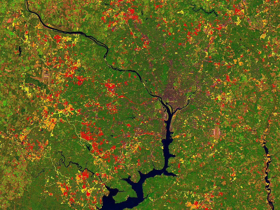
| Washington DC. Coloured satellite image showing the urban growth of Washington DC,capital and administrative centre of the United States. North is at top. Periods of urban growth are colour- coded: 1973- 1985 (red),1985-1990 (orange) and 1990- 1996 (yellow). Washington DC lies on the Potomac River (black). This image was produced from data collected by an American Landsat satellite in 1996,along with Landsat data from 1973,1985 and 1990 | |
| Licence : | Droits gérés |
| Crédit: | Science Photo Library / NASA's Goddard Space Flight Center |
| Taille de l’image : | 2560 px × 1920 px |
| Model Release : | Non requis |
| Property Release : | Non requis |
| Restrictions : | - |
Prix pour cette image À partir de 45 €
Produit vendu
(Calendrier, Carte postale, Carte de vœux, Impression sur textile, Packaging etc)
À partir de 45 €
Usage commercial
(Affichage, Annonce presse, Annonce TV, Carte, Digital - hors rés. sociaux, Digital - rés. sociaux etc)
À partir de 45 €
Éditorial
(Digital, Journal, Livre, Livre pratique, Magazine, Télévision etc)
À partir de 60 €
Usage non-commercial
(Digital - hors rés. sociaux, Digital - rés. sociaux etc)
À partir de 120 €