True-colour satellite image of Paris,France
Numéro d’image : 11748720
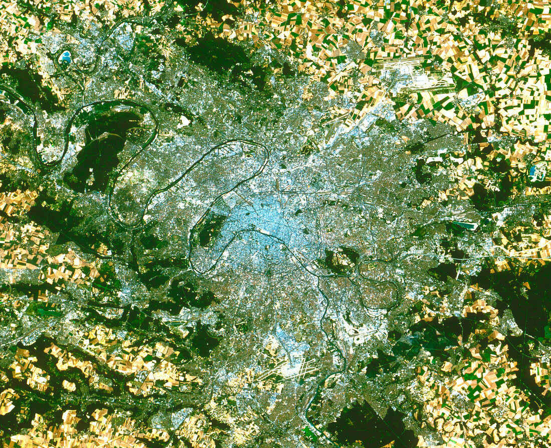
| Paris. True-colour satellite image of Paris,capital & largest city of France. North is at top. Urban areas appear in shades of grey. Forests are dark green,grazing areas are light green,& crops are mostly yellow. Bare ground appears pale yellow or brown,almost white. Rivers such as the Seine (flowing from bottom right to top left) and Marne (from far right to the Seine) appear black. Paris is surrounded by a patchwork of agricultural fields. The Paris-Orly (lower centre) and Charles de Gaulle (upper right) airports are also seen. Image taken by the American Landsat-5 satellite. The smallest visible objects are 30 metres across | |
| Licence : | Droits gérés |
| Crédit: | Science Photo Library / Planetobserver |
| Taille de l’image : | 3594 px × 2926 px |
| Model Release : | Non requis |
| Property Release : | Non requis |
| Restrictions : | - |
Prix pour cette image À partir de 45 €
Produit vendu
(Calendrier, Carte postale, Carte de vœux, Impression sur textile, Packaging etc)
À partir de 45 €
Usage commercial
(Affichage, Annonce presse, Annonce TV, Carte, Digital - hors rés. sociaux, Digital - rés. sociaux etc)
À partir de 45 €
Éditorial
(Digital, Journal, Livre, Livre pratique, Magazine, Télévision etc)
À partir de 60 €
Usage non-commercial
(Digital - hors rés. sociaux, Digital - rés. sociaux etc)
À partir de 120 €