True-colour satellite image of Hamburg,Germany
Numéro d’image : 11748712
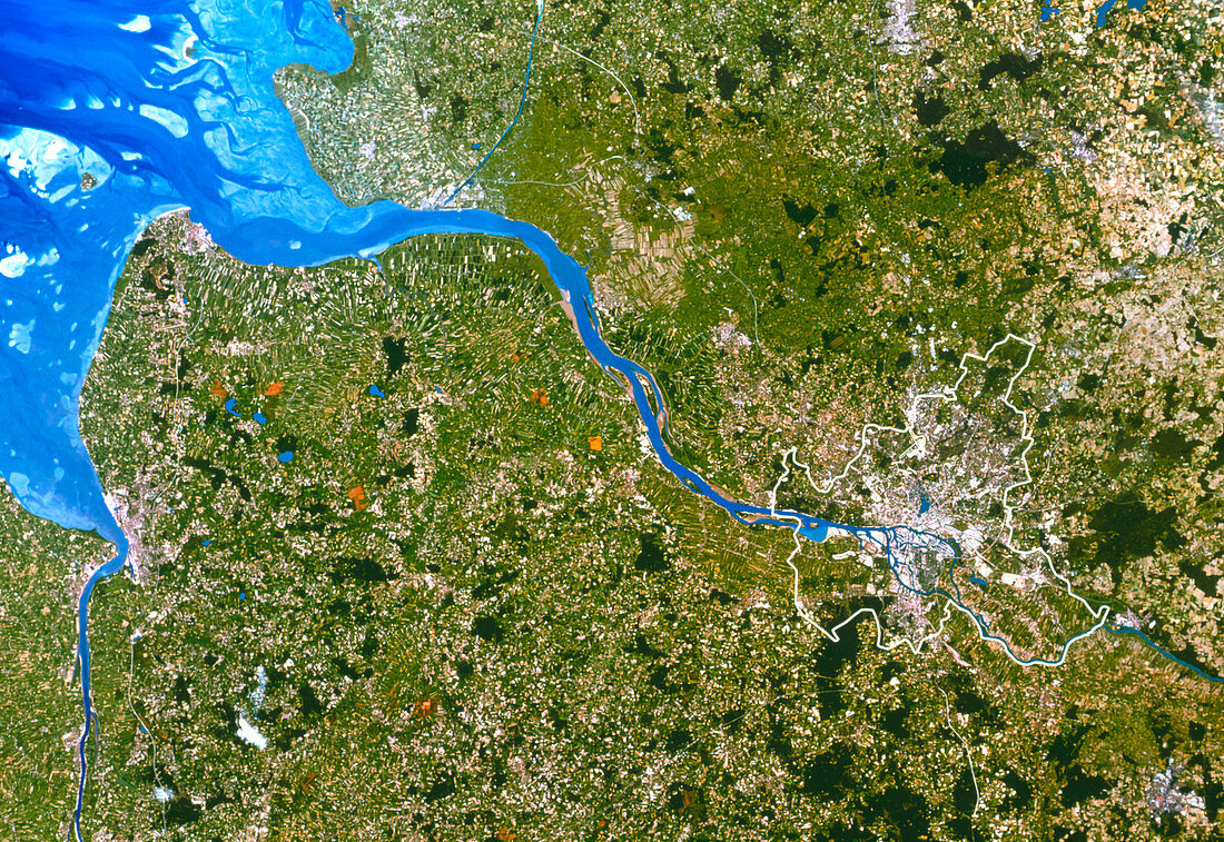
| Hamburg. True-colour satellite image of Hamburg (centre right),Germany. North is at top. Hamburg is one of Germany's 16 states (Lander); the city's limits are outlined in white. Urban areas such as Hamburg and Bremerhaven (far left) appear grey. Forests are dark green,grazing lands are light green and crops are mostly yellow. Bare ground appears pale yellow or brown,almost white. Hamburg lies on the Elbe River (blue),whilst the Weser estuary is at left. Variations in colour in the North Sea (upper left) are due to depth,currents and river discharges. Image taken by the American Landsat-5 satellite. The smallest visible features are 30 metres across | |
| Licence : | Droits gérés |
| Crédit: | Science Photo Library / Planetobserver |
| Taille de l’image : | 3619 px × 2489 px |
| Model Release : | Non requis |
| Property Release : | Non requis |
| Restrictions : | - |
Prix pour cette image À partir de 45 €
Produit vendu
(Calendrier, Carte postale, Carte de vœux, Impression sur textile, Packaging etc)
À partir de 45 €
Usage commercial
(Affichage, Annonce presse, Annonce TV, Carte, Digital - hors rés. sociaux, Digital - rés. sociaux etc)
À partir de 45 €
Éditorial
(Digital, Journal, Livre, Livre pratique, Magazine, Télévision etc)
À partir de 60 €
Usage non-commercial
(Digital - hors rés. sociaux, Digital - rés. sociaux etc)
À partir de 120 €