Satellite mosaic of New Orleans,USA
Numéro d’image : 11748695
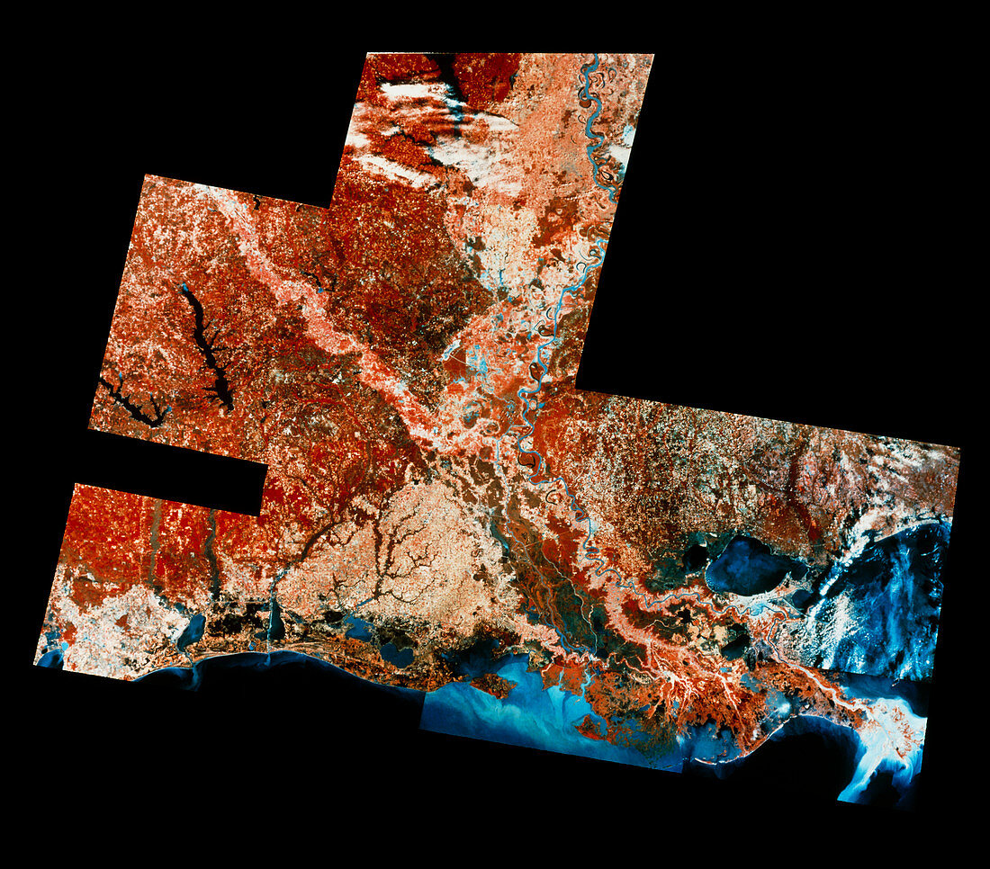
| New Orleans. Infrared satellite mosaic image of New Orleans and most of the state of Louisiana,USA. North is at top. In the infrared range,green vegetation appears red,buildings are light blue,water is blue/black and clouds are white. New Orleans,a major centre for transport,commerce and tourism,is at lower right between Lake Pontchartrain and the Mississippi river. The river follows a snaking path from top centre to its delta at bottom right. The dark colouration around New Orleans shows that much of the area is swampland. Image taken by the American Landsat Satellite | |
| Licence : | Droits gérés |
| Crédit: | Science Photo Library / MDA Information Systems |
| Taille de l’image : | 4788 px × 4206 px |
| Model Release : | Non requis |
| Property Release : | Non requis |
| Restrictions : | - |
Prix pour cette image À partir de 45 €
Produit vendu
(Calendrier, Carte postale, Carte de vœux, Impression sur textile, Packaging etc)
À partir de 45 €
Usage commercial
(Affichage, Annonce presse, Annonce TV, Carte, Digital - hors rés. sociaux, Digital - rés. sociaux etc)
À partir de 45 €
Éditorial
(Digital, Journal, Livre, Livre pratique, Magazine, Télévision etc)
À partir de 60 €
Usage non-commercial
(Digital - hors rés. sociaux, Digital - rés. sociaux etc)
À partir de 120 €