Infrared Landsat satellite image of Venice
Numéro d’image : 11748693
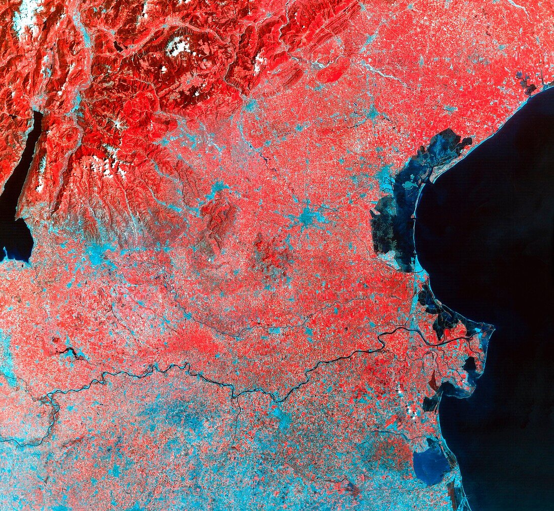
| Venice. Infrared Landsat satellite image of Venice (pale blue island in lagoon at right) and the surrounding area of northeast Italy. North is at top. Vegetation appears red,water black,urban areas blue. On the right is the Adriatic Sea. The Italian Alps and Lake Garda appear in the upper left. The string of towns between the Lake and Venice are (from left): Verona,Vicenza,Padua and Mestre (a suburb of Venice on the bank of the lagoon). The dark squiggle in the south of Venice is the Grand Canal. The River Po runs across the lower frame | |
| Licence : | Droits gérés |
| Crédit: | Science Photo Library / MDA Information Systems |
| Taille de l’image : | 4372 px × 4031 px |
| Model Release : | Non requis |
| Property Release : | Non requis |
| Restrictions : | - |
Prix pour cette image À partir de 45 €
Produit vendu
(Calendrier, Carte postale, Carte de vœux, Impression sur textile, Packaging etc)
À partir de 45 €
Usage commercial
(Affichage, Annonce presse, Annonce TV, Carte, Digital - hors rés. sociaux, Digital - rés. sociaux etc)
À partir de 45 €
Éditorial
(Digital, Journal, Livre, Livre pratique, Magazine, Télévision etc)
À partir de 60 €
Usage non-commercial
(Digital - hors rés. sociaux, Digital - rés. sociaux etc)
À partir de 120 €