Landsat satellite image of Chicago,USA
Numéro d’image : 11748689
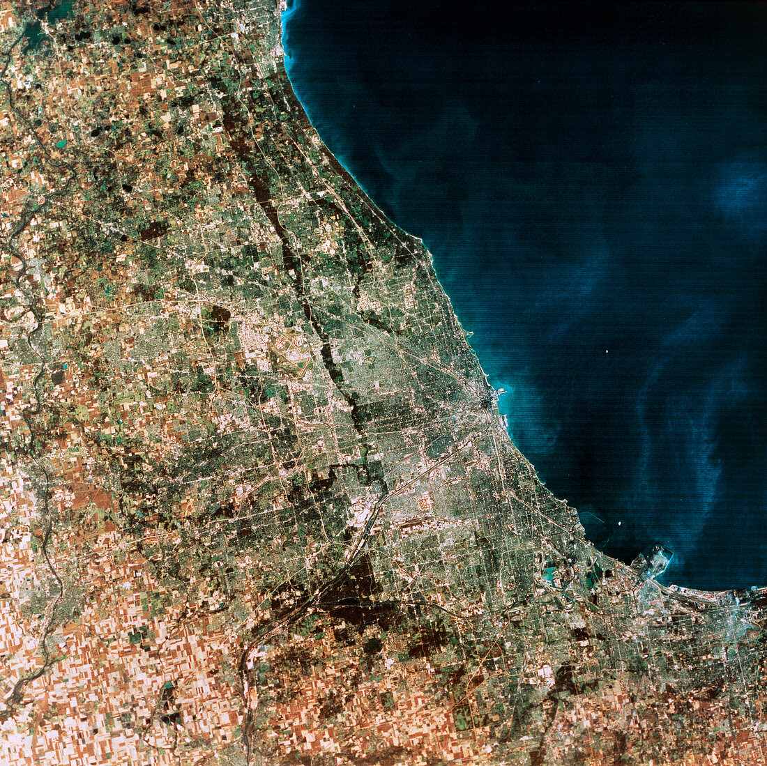
| Chicago. Landsat satellite image of Chicago,USA. North is towards the top. Chicago lies on the southwest coast of Lake Michigan (blue). Running into the city from just left of lower centre is the Chicago Ship Canal,which passes through the town of Joliet before reaching Chicago proper. Note the grid-like layout of streets,typical of American cities. The brown line running north- south through the city is a river. West of the river in the north of the city is an airport. The patchwork of brown and white rectangles in the lower left is agricultural land. This image was made by Landsat's thematic mapper | |
| Licence : | Droits gérés |
| Crédit: | Science Photo Library / MDA Information Systems |
| Taille de l’image : | 5159 px × 5155 px |
| Model Release : | Non requis |
| Property Release : | Non requis |
| Restrictions : | - |
Prix pour cette image À partir de 45 €
Produit vendu
(Calendrier, Carte postale, Carte de vœux, Impression sur textile, Packaging etc)
À partir de 45 €
Usage commercial
(Affichage, Annonce presse, Annonce TV, Carte, Digital - hors rés. sociaux, Digital - rés. sociaux etc)
À partir de 45 €
Éditorial
(Digital, Journal, Livre, Livre pratique, Magazine, Télévision etc)
À partir de 60 €
Usage non-commercial
(Digital - hors rés. sociaux, Digital - rés. sociaux etc)
À partir de 120 €