Coloured radar satellite image of Berlin,Germany
Numéro d’image : 11748681
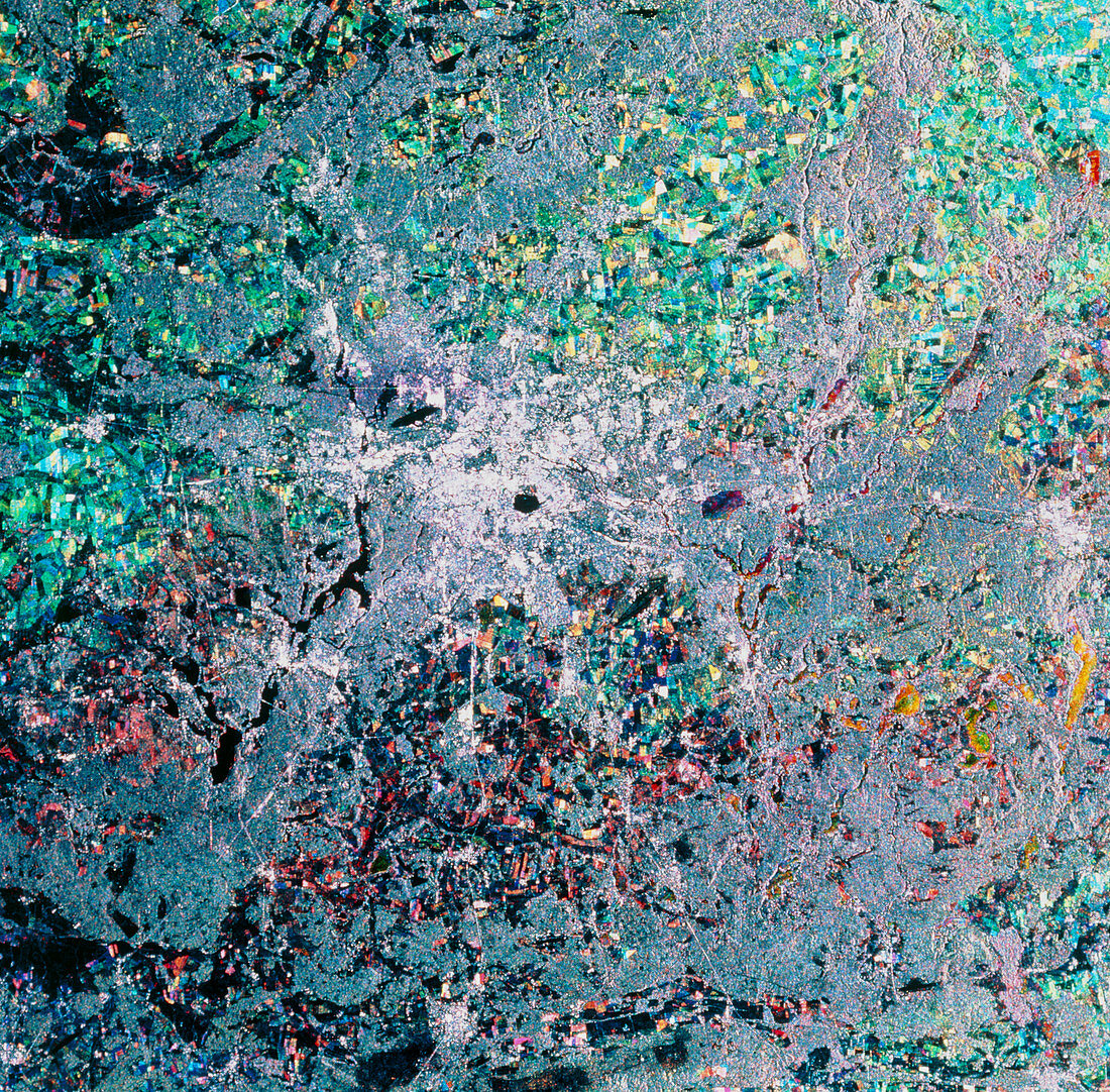
| Berlin. Coloured radar satellite image of Berlin (white,centre),capital of Germany. North is towards the top. This image was made by combining three frames taken on different dates. Differences between the frames show as areas of colour. Farmland is mostly blue,green and yellow,the different colours indicating growth of different crops between the frames. Unchanged areas appear white or black. The black circle in the city is Tempelhof Airport. Berlin was divided in 1949 after World War II and reunified in 1990. Image produced by European Radar Satellite 1. The area shown is approximately 100km x 100km | |
| Licence : | Droits gérés |
| Crédit: | Science Photo Library / ESA, EURIMAGE |
| Taille de l’image : | 4370 px × 4297 px |
| Model Release : | Non requis |
| Property Release : | Non requis |
| Restrictions : |
|
Prix pour cette image À partir de 45 €
Produit vendu
(Calendrier, Carte postale, Carte de vœux, Impression sur textile, Packaging etc)
À partir de 45 €
Usage commercial
(Affichage, Annonce presse, Annonce TV, Carte, Digital - hors rés. sociaux, Digital - rés. sociaux etc)
À partir de 45 €
Éditorial
(Digital, Journal, Livre, Livre pratique, Magazine, Télévision etc)
À partir de 60 €
Usage non-commercial
(Digital - hors rés. sociaux, Digital - rés. sociaux etc)
À partir de 120 €