Coloured radar satellite image of Copenhagen
Numéro d’image : 11748680
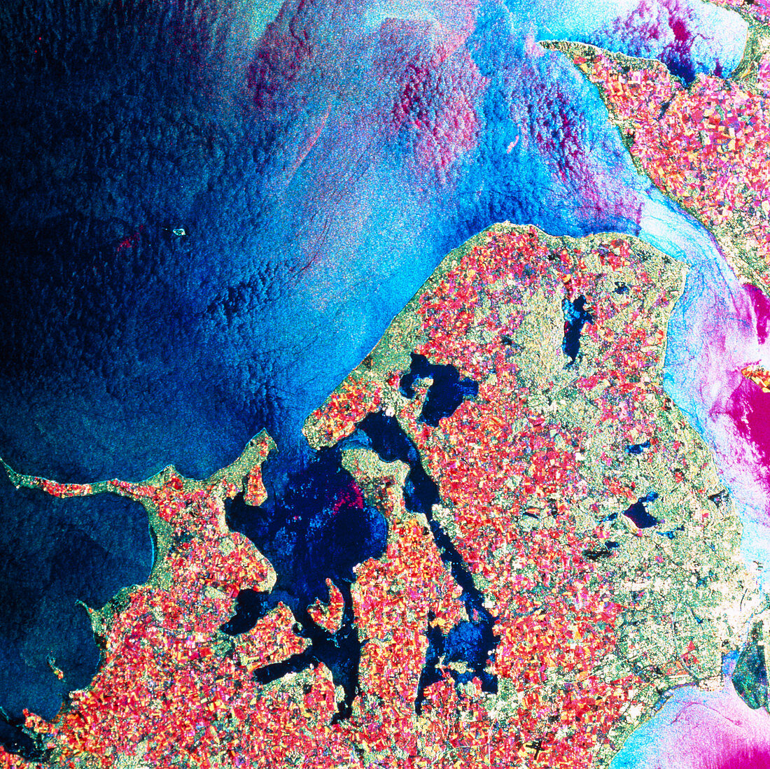
| Copenhagen. Coloured radar satellite image of the Danish capital Copenhagen (white,lower right). North is towards the top. This image was made by combining three frames taken on different dates. Differences between the frames show as areas of colour. Agricultural land appears in various colours,reflecting growth of different types of crop between frames. Copenhagen is split between the islands of Zealand (main landmass) and Amager (small island,lower right). Part of Sweden is visible in the top right. The colours on the sea indicate changes in wave pattern and height. Image produced by European Radar Satellite 1. The area shown is approximately 100km x 100km | |
| Licence : | Droits gérés |
| Crédit: | Science Photo Library / ESA, EURIMAGE |
| Taille de l’image : | 4252 px × 4248 px |
| Model Release : | Non requis |
| Property Release : | Non requis |
| Restrictions : |
|
Prix pour cette image À partir de 45 €
Produit vendu
(Calendrier, Carte postale, Carte de vœux, Impression sur textile, Packaging etc)
À partir de 45 €
Usage commercial
(Affichage, Annonce presse, Annonce TV, Carte, Digital - hors rés. sociaux, Digital - rés. sociaux etc)
À partir de 45 €
Éditorial
(Digital, Journal, Livre, Livre pratique, Magazine, Télévision etc)
À partir de 60 €
Usage non-commercial
(Digital - hors rés. sociaux, Digital - rés. sociaux etc)
À partir de 120 €