Edinburgh,seen from space
Numéro d’image : 11748664
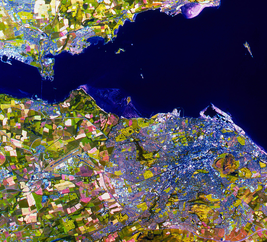
| Edinburgh seen from space. Satellite image of the city of Edinburgh,Scotland. This image has been processed to approximate to natural tones. The city is at right,bordering on the Firth of Forth estuary. To the west (left) of the city is Turnhouse Airport. North of the airport are two bridges across the River Forth,the road bridge (left) and the rail bridge (right). Sediment flows in the water are clearly seen. Most of the land around the city is used as pasture,although some cultivation is evident in the pale fields. The data for this image were gathered by a French SPOT satellite | |
| Licence : | Droits gérés |
| Crédit: | Science Photo Library / NRSC LTD |
| Taille de l’image : | 2372 px × 2148 px |
| Model Release : | Non requis |
| Property Release : | Non requis |
| Restrictions : | - |
Prix pour cette image À partir de 45 €
Produit vendu
(Calendrier, Carte postale, Carte de vœux, Impression sur textile, Packaging etc)
À partir de 45 €
Usage commercial
(Affichage, Annonce presse, Annonce TV, Carte, Digital - hors rés. sociaux, Digital - rés. sociaux etc)
À partir de 45 €
Éditorial
(Digital, Journal, Livre, Livre pratique, Magazine, Télévision etc)
À partir de 60 €
Usage non-commercial
(Digital - hors rés. sociaux, Digital - rés. sociaux etc)
À partir de 120 €