False-colour satellite image of London
Numéro d’image : 11748662
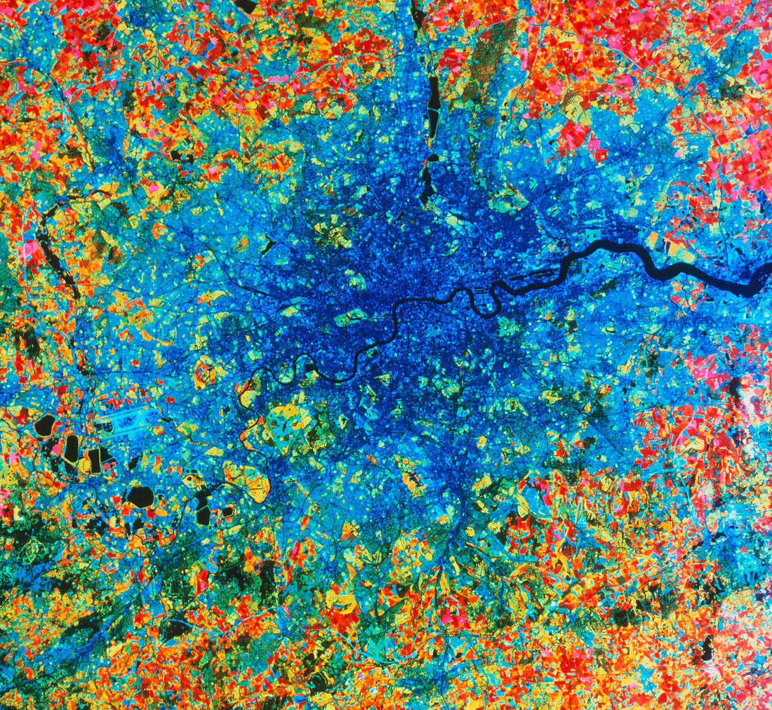
| Greater London,seen from space. In this false- colour view,urban areas are shown as blue; light blue shows mainly residential areas and darker blue mainly commercial regions. The River Thames is seen running across the centre of the frame. Pale green and orange areas are grassland,darker orange and red denotes arable land. The line of black features at centre left are reservoirs,just above which is Heathrow Airport. Central London features include Hyde Park (centre,rectangular),just above this is the more circular patch of Regent's Park. The U-shaped bend in the river right of centre encloses Docklands. This image was made by the Landsat satellite in May 1985 | |
| Licence : | Droits gérés |
| Crédit: | Science Photo Library / NRSC LTD |
| Taille de l’image : | 3928 px × 3612 px |
| Model Release : | Non requis |
| Property Release : | Non requis |
| Restrictions : | - |
Prix pour cette image À partir de 45 €
Produit vendu
(Calendrier, Carte postale, Carte de vœux, Impression sur textile, Packaging etc)
À partir de 45 €
Usage commercial
(Affichage, Annonce presse, Annonce TV, Carte, Digital - hors rés. sociaux, Digital - rés. sociaux etc)
À partir de 45 €
Éditorial
(Digital, Journal, Livre, Livre pratique, Magazine, Télévision etc)
À partir de 60 €
Usage non-commercial
(Digital - hors rés. sociaux, Digital - rés. sociaux etc)
À partir de 120 €