Landsat image of Tokyo
Numéro d’image : 11748656
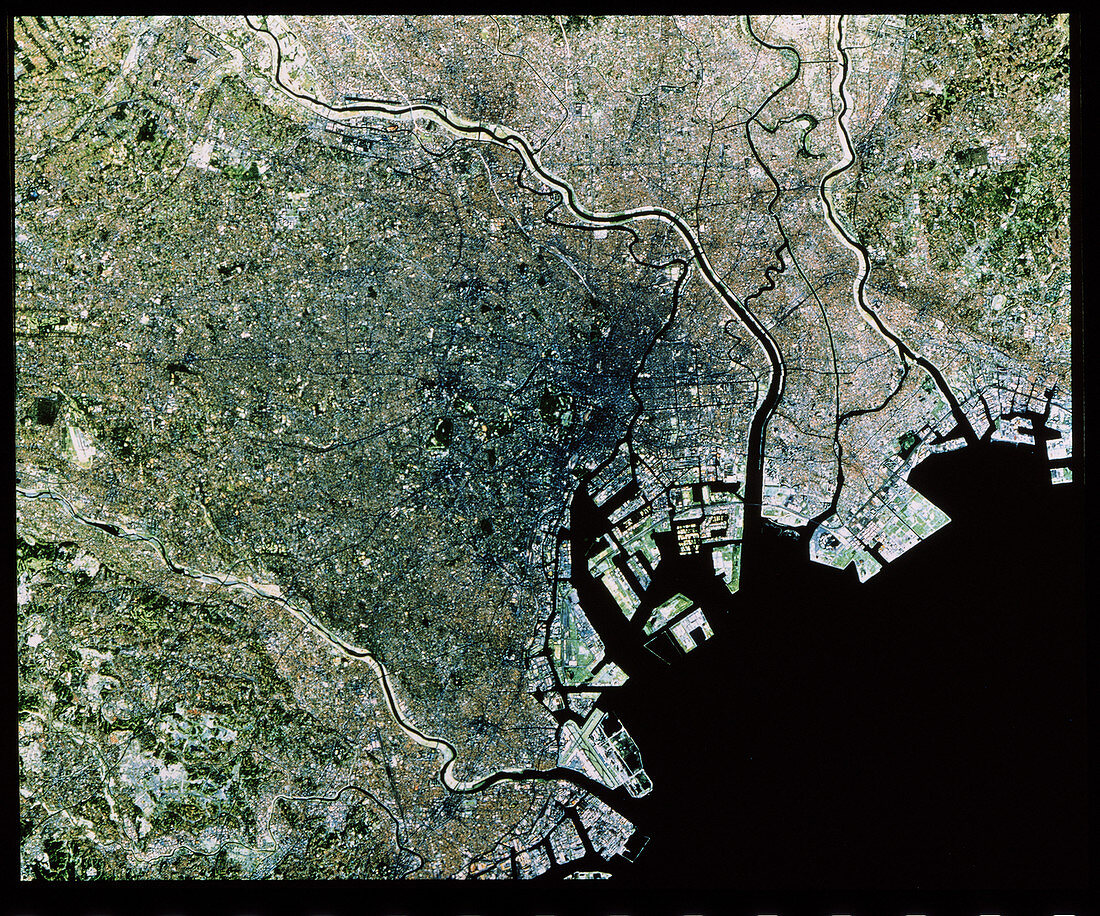
| Satellite image of the Tokyo Metropolitan Area. The colours in land areas have been processed to approximate to natural tones. Three main rivers are seen: Tama-gawa (near bottom left),Arakawa- hosuiro (upper centre),and Edo-gawa (upper right). The small green area at centre frame is the grounds of the Imperial Palace. The port area is shown very clearly,the isolated block-shaped islands are reclaimed land. The runways of Tokyo's Haneda Airport are seen at bottom centre. The urban area in lower left is Yokohama,now part of the Tokyo metropolis. Tokyo's population is about 15 million (1989). This image was gathered by a Landsat satellite on 4 November 1984 | |
| Licence : | Droits gérés |
| Crédit: | Science Photo Library / Restec, Japan |
| Taille de l’image : | 4300 px × 3581 px |
| Model Release : | Non requis |
| Property Release : | Non requis |
| Restrictions : |
|
Prix pour cette image À partir de 45 €
Produit vendu
(Calendrier, Carte postale, Carte de vœux, Impression sur textile, Packaging etc)
À partir de 45 €
Usage commercial
(Affichage, Annonce presse, Annonce TV, Carte, Digital - hors rés. sociaux, Digital - rés. sociaux etc)
À partir de 45 €
Éditorial
(Digital, Journal, Livre, Livre pratique, Magazine, Télévision etc)
À partir de 60 €
Usage non-commercial
(Digital - hors rés. sociaux, Digital - rés. sociaux etc)
À partir de 120 €