Landsat TM image of Manchester,England
Numéro d’image : 11748655
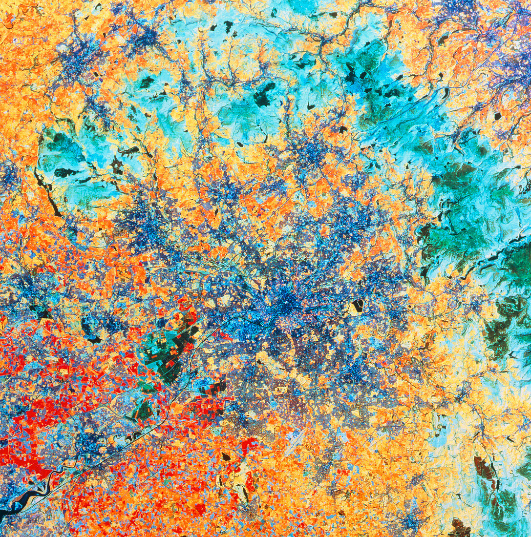
| False-colour satellite image of the area around the city of Manchester,England. The city is in the middle of the dark blue patch at centre frame. Urban sprawl has linked it to other towns,such as Stockport (lower right) and Oldham (upper right). Manchester Airport is at the bottom centre edge of the urban sprawl. The green area (upper half of frame) is part of the Pennine Mountains,on the far side of which are the towns of Halifax and Huddersfield (top right). Manchester is linked to the estuary of the River Mersey (at bottom left),and thus the sea,by the Manchester Ship Canal which was completed in 1894. This image was made using the Thematic Mapper of a Landsat satellite | |
| Licence : | Droits gérés |
| Crédit: | Science Photo Library / NRSC LTD |
| Taille de l’image : | 4593 px × 4647 px |
| Model Release : | Non requis |
| Property Release : | Non requis |
| Restrictions : | - |
Prix pour cette image À partir de 45 €
Produit vendu
(Calendrier, Carte postale, Carte de vœux, Impression sur textile, Packaging etc)
À partir de 45 €
Usage commercial
(Affichage, Annonce presse, Annonce TV, Carte, Digital - hors rés. sociaux, Digital - rés. sociaux etc)
À partir de 45 €
Éditorial
(Digital, Journal, Livre, Livre pratique, Magazine, Télévision etc)
À partir de 60 €
Usage non-commercial
(Digital - hors rés. sociaux, Digital - rés. sociaux etc)
À partir de 120 €