Landsat TM image of Liverpool,England
Numéro d’image : 11748654
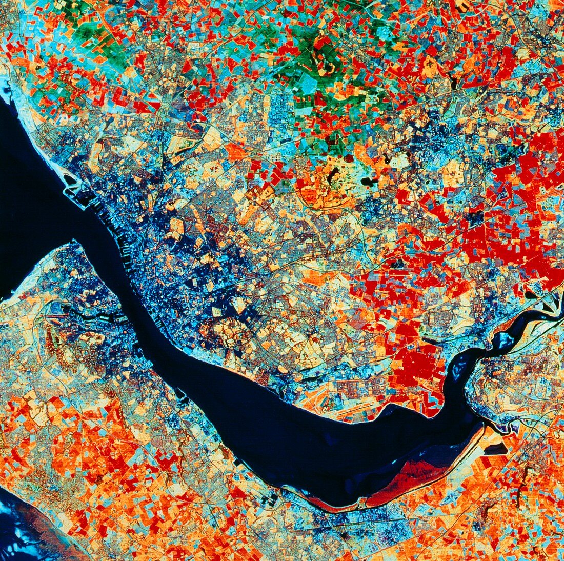
| False-colour satellite image of the area around Liverpool,England. The prominent dark area is the estuary of the River Mersey. Liverpool is on the north (upper) bank of the Mersey at left,its extensive cargo docks seen clearly. On the opposite bank of the river is Birkenhead,a town famous for ship building,at the end of a peninsula called The Wirral. On the north bank below centre is the single black runway of Liverpool Airport. On either side of the Mersey at right are Widnes (north) and Runcorn (south). The dark blue patch above Widnes at right is St.Helens. This image was made using data from the Thematic Mapper of a Landsat satellite | |
| Licence : | Droits gérés |
| Crédit: | Science Photo Library / NRSC LTD |
| Taille de l’image : | 4194 px × 4172 px |
| Model Release : | Non requis |
| Property Release : | Non requis |
| Restrictions : | - |
Prix pour cette image À partir de 45 €
Produit vendu
(Calendrier, Carte postale, Carte de vœux, Impression sur textile, Packaging etc)
À partir de 45 €
Usage commercial
(Affichage, Annonce presse, Annonce TV, Carte, Digital - hors rés. sociaux, Digital - rés. sociaux etc)
À partir de 45 €
Éditorial
(Digital, Journal, Livre, Livre pratique, Magazine, Télévision etc)
À partir de 60 €
Usage non-commercial
(Digital - hors rés. sociaux, Digital - rés. sociaux etc)
À partir de 120 €