Landsat TM image of central London,England
Numéro d’image : 11748653
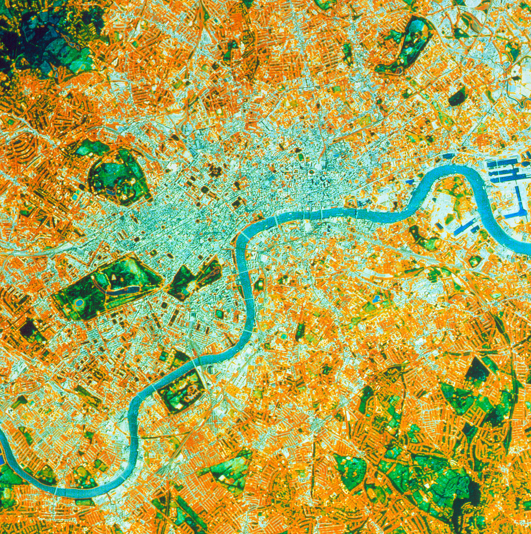
| False-colour satellite image of central London,England. The image approximates to true colours. The centre of London is seen as a grey patch,with the West End to the left,Isle of Dogs at right. The surrounding brown- coloured areas are primarily residential,and the city's parks and open spaces are shown as dark green. The River Thames runs across the image,from Barnes in the bottom left to Docklands at top right. Major roads and railway routes are clearly visible. The frame covers approximately 250 square kilometres. SPL's office is located just inside the frame at centre left. This image was made from data gathered by the Thematic Mapper of a Landsat satellite | |
| Licence : | Droits gérés |
| Crédit: | Science Photo Library / NRSC LTD |
| Taille de l’image : | 3525 px × 3543 px |
| Model Release : | Non requis |
| Property Release : | Non requis |
| Restrictions : | - |
Prix pour cette image À partir de 45 €
Produit vendu
(Calendrier, Carte postale, Carte de vœux, Impression sur textile, Packaging etc)
À partir de 45 €
Usage commercial
(Affichage, Annonce presse, Annonce TV, Carte, Digital - hors rés. sociaux, Digital - rés. sociaux etc)
À partir de 45 €
Éditorial
(Digital, Journal, Livre, Livre pratique, Magazine, Télévision etc)
À partir de 60 €
Usage non-commercial
(Digital - hors rés. sociaux, Digital - rés. sociaux etc)
À partir de 120 €