SPOT satellite image of the city of London
Numéro d’image : 11748637
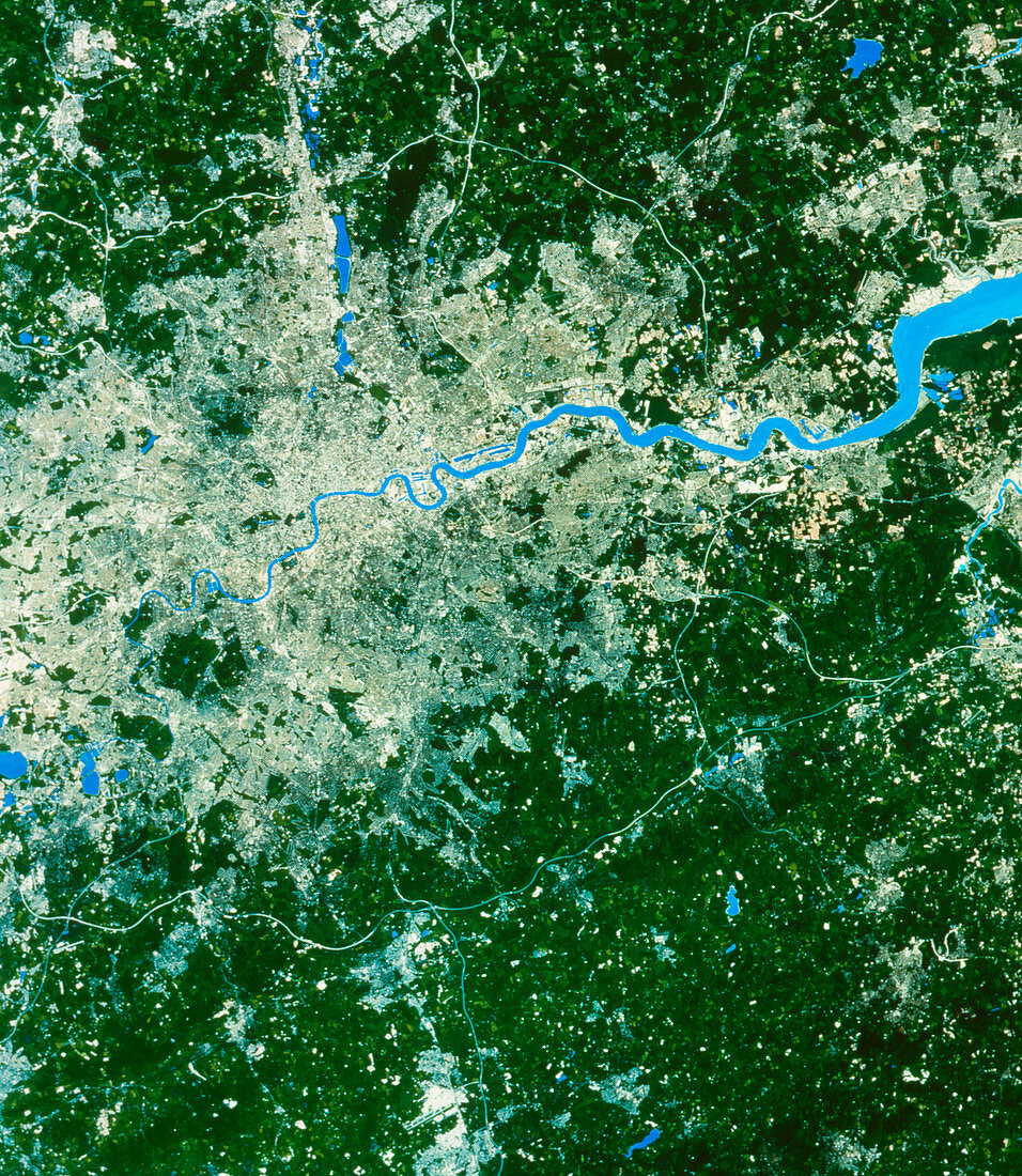
| SPOT satellite image of the city of London. The city is dominated by the River Thames,which runs through it from west to east. The chain of lakes running northward from the city are the Lea Valley reserviors which supply a large proportion of London's water. Heathrow airport can be seen near another large group of reserviors on the left of the image. London's second airport,Gatwick,is visible near the bottom edge of the photograph. The London orbital motorway,the M25,is clearly seen encircling the city | |
| Licence : | Droits gérés |
| Crédit: | Science Photo Library / Maptec International |
| Taille de l’image : | 3078 px × 3543 px |
| Model Release : | Non requis |
| Property Release : | Non requis |
| Restrictions : | - |
Prix pour cette image À partir de 45 €
Produit vendu
(Calendrier, Carte postale, Carte de vœux, Impression sur textile, Packaging etc)
À partir de 45 €
Usage commercial
(Affichage, Annonce presse, Annonce TV, Carte, Digital - hors rés. sociaux, Digital - rés. sociaux etc)
À partir de 45 €
Éditorial
(Digital, Journal, Livre, Livre pratique, Magazine, Télévision etc)
À partir de 60 €
Usage non-commercial
(Digital - hors rés. sociaux, Digital - rés. sociaux etc)
À partir de 120 €