Landsat image of Cape Town and surroundings
Numéro d’image : 11746462
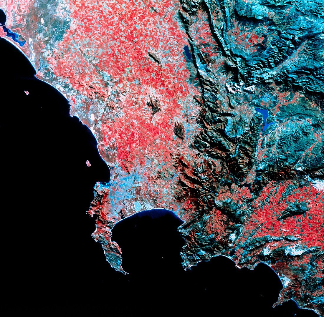
| The area around the Cape Peninsula,South Africa,seen from space. In this false-colour view,arable land is shown as red and urban areas are shown as light blue. Cape Peninsula is at the left of False Bay just below centre. Near the top of the peninsula is Cape Town,at the bottom is the Cape of Good Hope. The dark area on the coast next to Cape Town is the Table Mountain group which reaches a height of 1086 metres. Just to the right of Cape Town is a region of vineyards. Along the coast at bottom right is the Hottentot-Holland Range. At top right is part of the Great Escarpment,the edge of the South African Plateau. This image was made by Landsat 4 in 1983 | |
| Licence : | Droits gérés |
| Crédit: | Science Photo Library / NRSC LTD |
| Taille de l’image : | 4229 px × 4141 px |
| Model Release : | Non requis |
| Property Release : | Non requis |
| Restrictions : | - |
Prix pour cette image À partir de 45 €
Produit vendu
(Calendrier, Carte postale, Carte de vœux, Impression sur textile, Packaging etc)
À partir de 45 €
Usage commercial
(Affichage, Annonce presse, Annonce TV, Carte, Digital - hors rés. sociaux, Digital - rés. sociaux etc)
À partir de 45 €
Éditorial
(Digital, Journal, Livre, Livre pratique, Magazine, Télévision etc)
À partir de 60 €
Usage non-commercial
(Digital - hors rés. sociaux, Digital - rés. sociaux etc)
À partir de 120 €