Landsat view of deforestation,Ivory Coast
Numéro d’image : 11745976
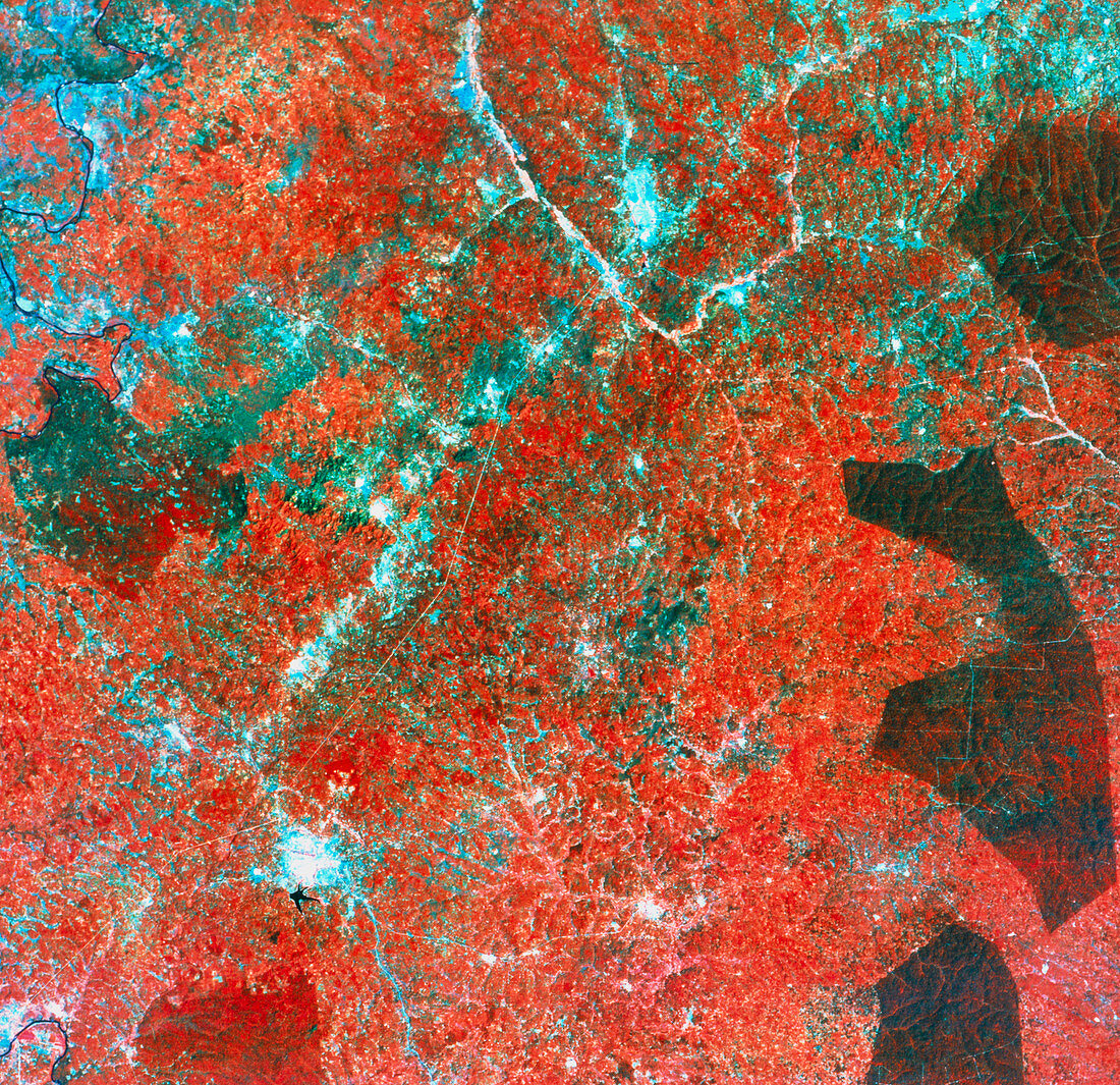
| Deforestation in Africa. Coloured satellite image highlighting deforestation around the town of Abengourou (bottom left,pale blue),Ivory Coast,Africa. The colours in the image depict different surface cover: red is the natural forest,brown areas are plantations and pale blue areas are bare soil. The main centres of forest loss are around villages,but forest loss also occurs along natural contours (for example in valleys). This image was gathered by a Landsat satellite | |
| Licence : | Droits gérés |
| Crédit: | Science Photo Library / MDA Information Systems |
| Taille de l’image : | 4271 px × 4134 px |
| Model Release : | Non requis |
| Property Release : | Non requis |
| Restrictions : | - |
Prix pour cette image À partir de 45 €
Produit vendu
(Calendrier, Carte postale, Carte de vœux, Impression sur textile, Packaging etc)
À partir de 45 €
Usage commercial
(Affichage, Annonce presse, Annonce TV, Carte, Digital - hors rés. sociaux, Digital - rés. sociaux etc)
À partir de 45 €
Éditorial
(Digital, Journal, Livre, Livre pratique, Magazine, Télévision etc)
À partir de 60 €
Usage non-commercial
(Digital - hors rés. sociaux, Digital - rés. sociaux etc)
À partir de 120 €