Deforestation in Brazil
Numéro d’image : 11745946
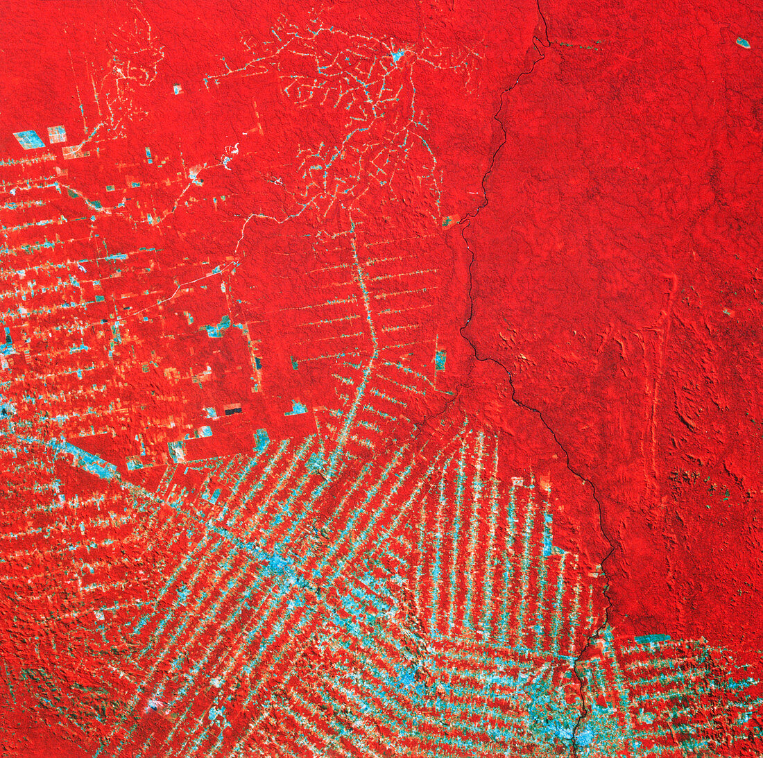
| Landsat thematic mapper image of deforestation in Rondonia,western Brazil. Recorded in 1988,it shows an area of rainforest approximately 240 kilometres square. Areas of dense vegetation appear red. The distinctive pattern of blue lines reveals systematic deforestation on a huge scale resulting from the practice of "slash & burn" farming. This method of agriculture is employed by farmers relocated by the government to Rondonia due to severe poverty in other regions of Brazil. Most of the nutrients in the forest are locked up in the trees; when released into the soil by burning cleared wood they are rapidly exhausted,forcing farmers to repeat the process elsewhere. Resolution: 30 metres | |
| Licence : | Droits gérés |
| Crédit: | Science Photo Library / NASA |
| Taille de l’image : | 3694 px × 3669 px |
| Model Release : | Non requis |
| Property Release : | Non requis |
| Restrictions : | - |
Prix pour cette image À partir de 45 €
Produit vendu
(Calendrier, Carte postale, Carte de vœux, Impression sur textile, Packaging etc)
À partir de 45 €
Usage commercial
(Affichage, Annonce presse, Annonce TV, Carte, Digital - hors rés. sociaux, Digital - rés. sociaux etc)
À partir de 45 €
Éditorial
(Digital, Journal, Livre, Livre pratique, Magazine, Télévision etc)
À partir de 60 €
Usage non-commercial
(Digital - hors rés. sociaux, Digital - rés. sociaux etc)
À partir de 120 €