Landsat image of the rain forests (Brazil)
Numéro d’image : 11745916
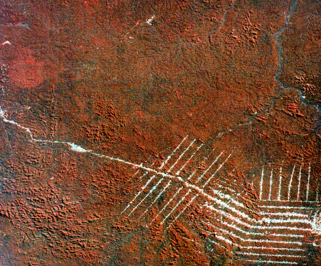
| Landsat image of the rain forests surrounding the Rondonia Development Project in Western Brazil. The image (recorded in June 1976),shows the initial deforestation (dense vegetation appears red) associated with a roadway (with its parallel side roads),driven through the forest in preparation for the families of "slash & burn" farmers whom the government relocated at Rondonia due to severe poverty in other regions of Brazil. Nutrients in soil are associated with root systems of trees; when released by burning cleared wood they are quickly exhausted & not replaced,forcing farmers to repeat the process elsewhere | |
| Licence : | Droits gérés |
| Crédit: | Science Photo Library / MDA Information Systems |
| Taille de l’image : | 3543 px × 2945 px |
| Model Release : | Non requis |
| Property Release : | Non requis |
| Restrictions : | - |
Prix pour cette image À partir de 45 €
Produit vendu
(Calendrier, Carte postale, Carte de vœux, Impression sur textile, Packaging etc)
À partir de 45 €
Usage commercial
(Affichage, Annonce presse, Annonce TV, Carte, Digital - hors rés. sociaux, Digital - rés. sociaux etc)
À partir de 45 €
Éditorial
(Digital, Journal, Livre, Livre pratique, Magazine, Télévision etc)
À partir de 60 €
Usage non-commercial
(Digital - hors rés. sociaux, Digital - rés. sociaux etc)
À partir de 120 €