Richat Structure,Mauritania,from ERS-1
Numéro d’image : 11745781
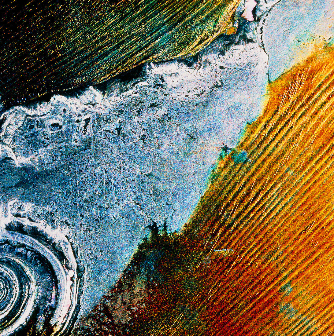
| The Richat Structure. Coloured radar satellite image of the Richat Structure (lower left) in the Sahara Desert,Mauritania. North is towards the top. This image was made by combining three frames taken at different dates. Differences between the frames show as areas of colour; unchanged areas appear white or black. The red areas are sand dune fields,their strong colour indicating movement of the sand with the wind. The blue-grey area is bare rock. The Richat Structure is a 40km- wide uplifted dome of rock. Erosion of the roof of the dome has exposed concentric rings of rock within. Image produced by European Radar Satellite 1. The area shown is approximately 100km x 100km | |
| Licence : | Droits gérés |
| Crédit: | Science Photo Library / ESA, EURIMAGE |
| Taille de l’image : | 3412 px × 3438 px |
| Model Release : | Non requis |
| Property Release : | Non requis |
| Restrictions : |
|
Prix pour cette image À partir de 45 €
Produit vendu
(Calendrier, Carte postale, Carte de vœux, Impression sur textile, Packaging etc)
À partir de 45 €
Usage commercial
(Affichage, Annonce presse, Annonce TV, Carte, Digital - hors rés. sociaux, Digital - rés. sociaux etc)
À partir de 45 €
Éditorial
(Digital, Journal, Livre, Livre pratique, Magazine, Télévision etc)
À partir de 60 €
Usage non-commercial
(Digital - hors rés. sociaux, Digital - rés. sociaux etc)
À partir de 120 €