Landsat photo of part of Namibia
Numéro d’image : 11745768
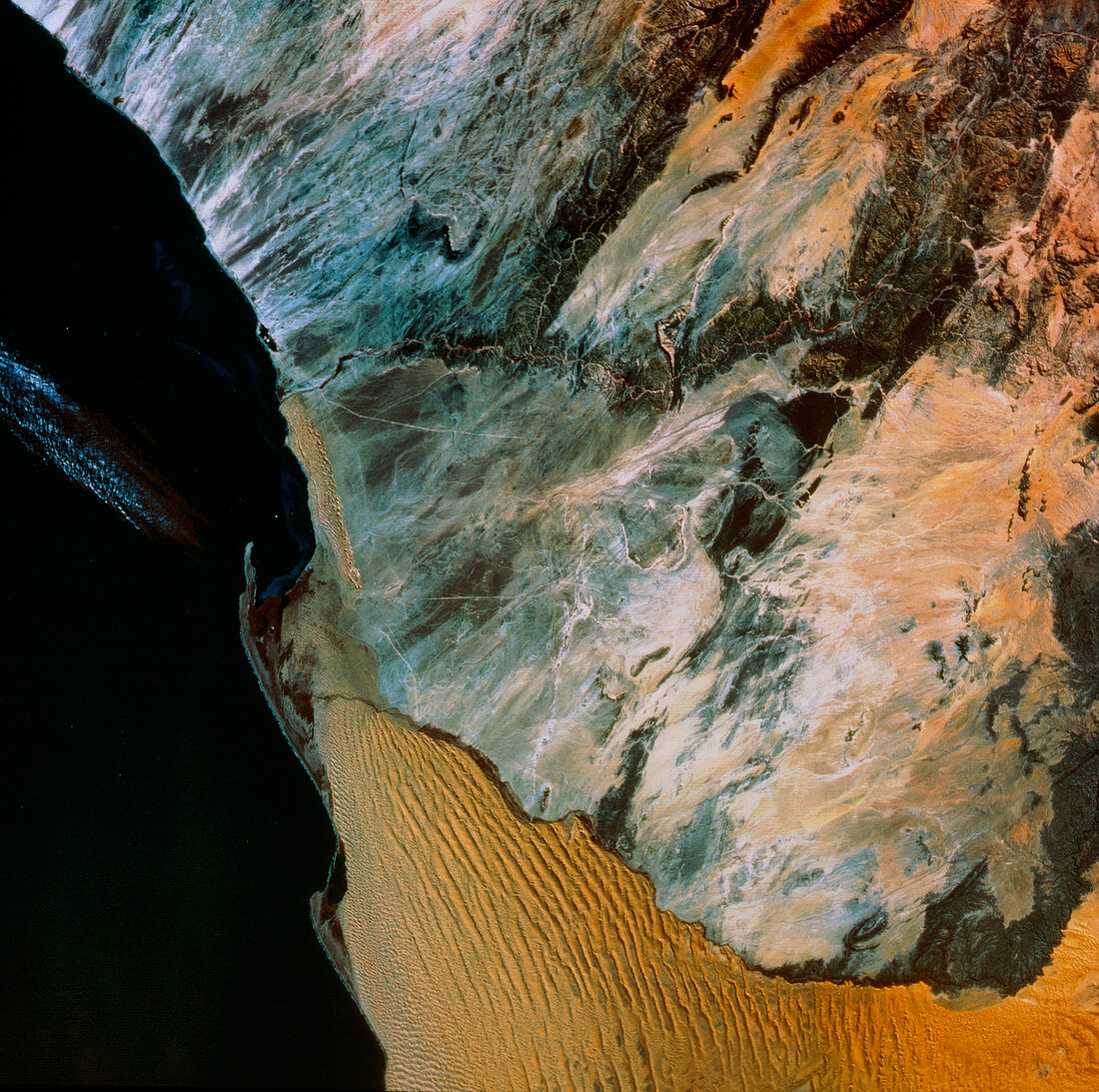
| Natural-colour Landsat satellite image of part of Namibia,Africa. This image clearly demonstrates the boundary between the two types of terrain in the Namib Desert: the sandy desert of the south (bottom) and the rocky desert of the north. The boundary is the seasonal Kuiseb River. A small oval feature,ringed with pale grey,may be seen just below top centre. This is Rossing,site of the world's largest uranium deposit. The orange- tinted terrain toward top right is part of the Khomas Highland | |
| Licence : | Droits gérés |
| Crédit: | Science Photo Library / MDA Information Systems |
| Taille de l’image : | 4989 px × 4958 px |
| Model Release : | Non requis |
| Property Release : | Non requis |
| Restrictions : | - |
Prix pour cette image À partir de 45 €
Produit vendu
(Calendrier, Carte postale, Carte de vœux, Impression sur textile, Packaging etc)
À partir de 45 €
Usage commercial
(Affichage, Annonce presse, Annonce TV, Carte, Digital - hors rés. sociaux, Digital - rés. sociaux etc)
À partir de 45 €
Éditorial
(Digital, Journal, Livre, Livre pratique, Magazine, Télévision etc)
À partir de 60 €
Usage non-commercial
(Digital - hors rés. sociaux, Digital - rés. sociaux etc)
À partir de 120 €