Richat Structure,Mauritania,from Shuttle
Numéro d’image : 11745756
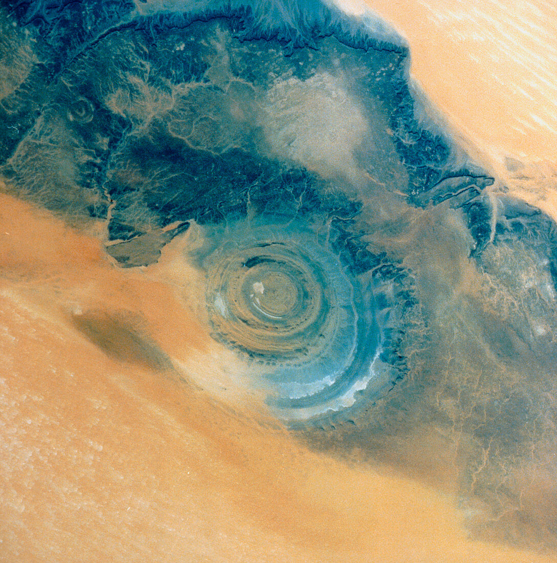
| The Richat Structure in the Sahara Desert,seen from Shuttle Atlantis during Mission STS-37. The Richat Structure is 40km across and was originally thought to be a meteorite impact crater. More recent analysis has led to the conclusion that the Structure was an uplifted dome of rocks,subsequent erosion of the 'roof' of the dome having exposed this cross-sectional 'slice' through the various layers. The Richat Structure is in Mauritania,and was first photographed from space from a Gemini spacecraft in 1965. Shuttle Mission STS-37 flew between 5-11 April 1991,with the primary task of launching the Gamma Ray Observatory satellite | |
| Licence : | Droits gérés |
| Crédit: | Science Photo Library / NASA |
| Taille de l’image : | 4908 px × 4957 px |
| Model Release : | Non requis |
| Property Release : | Non requis |
| Restrictions : | - |
Prix pour cette image À partir de 45 €
Produit vendu
(Calendrier, Carte postale, Carte de vœux, Impression sur textile, Packaging etc)
À partir de 45 €
Usage commercial
(Affichage, Annonce presse, Annonce TV, Carte, Digital - hors rés. sociaux, Digital - rés. sociaux etc)
À partir de 45 €
Éditorial
(Digital, Journal, Livre, Livre pratique, Magazine, Télévision etc)
À partir de 60 €
Usage non-commercial
(Digital - hors rés. sociaux, Digital - rés. sociaux etc)
À partir de 120 €