Landsat image of Sahara Desert
Numéro d’image : 11745750
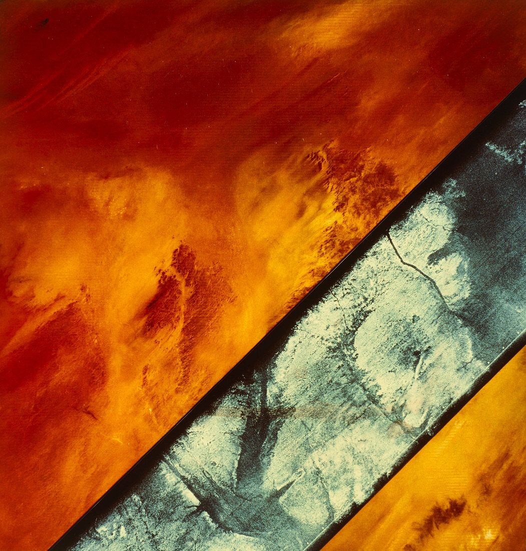
| Shuttle Imaging Radar-A image (black & white strip) integrated with a Landsat image of the Sahara Desert in the southeastern region of Egypt. The comparision (see E620/171) was designed to show the different details obtained by the two imaging techniques. The radar image penetrates the surface deposits of windblown sands & reveals drainage channels & bedrock features below. These are not visible on the Landsat image. Using radar to penetrate the land surface is only possible in arid regions since soil moisture reduces the penetration of the beam | |
| Licence : | Droits gérés |
| Crédit: | Science Photo Library / NASA |
| Taille de l’image : | 3647 px × 3817 px |
| Model Release : | Non requis |
| Property Release : | Non requis |
| Restrictions : | - |
Prix pour cette image À partir de 45 €
Produit vendu
(Calendrier, Carte postale, Carte de vœux, Impression sur textile, Packaging etc)
À partir de 45 €
Usage commercial
(Affichage, Annonce presse, Annonce TV, Carte, Digital - hors rés. sociaux, Digital - rés. sociaux etc)
À partir de 45 €
Éditorial
(Digital, Journal, Livre, Livre pratique, Magazine, Télévision etc)
À partir de 60 €
Usage non-commercial
(Digital - hors rés. sociaux, Digital - rés. sociaux etc)
À partir de 120 €