Landsat image of the desert showing sand dunes
Numéro d’image : 11745733
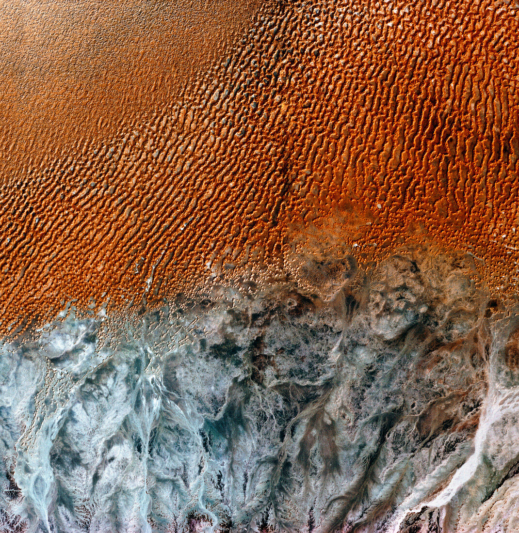
| Arabian desert. Infrared satellite image of the Arabian desert. North is at top. In the upper frame are sand dunes whilst barren rock appears grey in the lower frame. Dunes form in sandy areas where the prevailing wind usually blows from one direction. Image of Ramlat Mitan in western Oman,taken by the American Landsat satellite | |
| Licence : | Droits gérés |
| Crédit: | Science Photo Library / MDA Information Systems |
| Taille de l’image : | 4225 px × 4342 px |
| Model Release : | Non requis |
| Property Release : | Non requis |
| Restrictions : | - |
Prix pour cette image À partir de 45 €
Produit vendu
(Calendrier, Carte postale, Carte de vœux, Impression sur textile, Packaging etc)
À partir de 45 €
Usage commercial
(Affichage, Annonce presse, Annonce TV, Carte, Digital - hors rés. sociaux, Digital - rés. sociaux etc)
À partir de 45 €
Éditorial
(Digital, Journal, Livre, Livre pratique, Magazine, Télévision etc)
À partir de 60 €
Usage non-commercial
(Digital - hors rés. sociaux, Digital - rés. sociaux etc)
À partir de 120 €