Lakes Erie and Ontario
Numéro d’image : 11745439
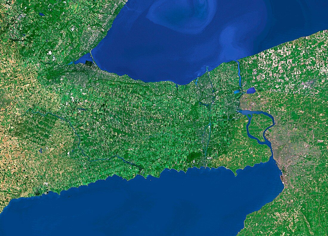
| Lakes Erie and Ontario. Satellite image of part of two of the Great Lakes,Ontario (upper) and Erie (lower). The lakes are linked by the Niagara river,at centre right. This river contains Niagara Falls,a large complex of waterfalls. The Niagara river forms part of the border between the Canadian province of Ontario (to the left) and the state of New York,USA (to the right). The brown patch at centre right is the city of Buffalo | |
| Licence : | Droits gérés |
| Crédit: | Science Photo Library / Worldsat International |
| Taille de l’image : | 5600 px × 4035 px |
| Model Release : | Non requis |
| Property Release : | Non requis |
| Restrictions : |
|
Prix pour cette image À partir de 45 €
Produit vendu
(Calendrier, Carte postale, Carte de vœux, Impression sur textile, Packaging etc)
À partir de 45 €
Usage commercial
(Affichage, Annonce presse, Annonce TV, Carte, Digital - hors rés. sociaux, Digital - rés. sociaux etc)
À partir de 45 €
Éditorial
(Digital, Journal, Livre, Livre pratique, Magazine, Télévision etc)
À partir de 60 €
Usage non-commercial
(Digital - hors rés. sociaux, Digital - rés. sociaux etc)
À partir de 120 €