Aral Sea,2001
Numéro d’image : 11745431
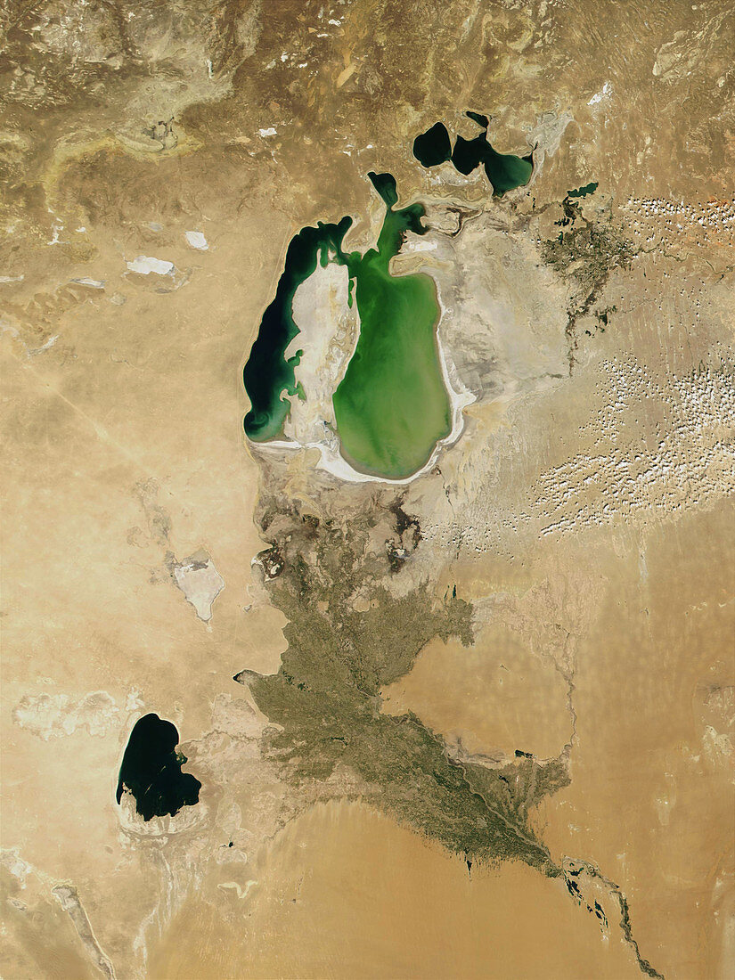
| Aral Sea,2001. Satellite image of the Aral Sea (green),surrounded by the arid lands of Uzbekistan (lower left) and Kazakhstan (upper right). This inland salt water lake used to be the fourth largest lake in the world,but excessive use of its source rivers (the Syr Darya and Amu Darya,dark brown,upper and bottom right respectively) for irrigation has reduced its water volume by over a half. This caused the lake's waterline to recede by many miles over the last two decades of the 20th Century. Image taken on 19 August 2001 by the Moderate Resolution Imaging Spectrometer (MODIS) on NASA's Terra satellite | |
| Licence : | Droits gérés |
| Crédit: | Science Photo Library / NASA |
| Taille de l’image : | 2400 px × 3200 px |
| Model Release : | Non requis |
| Property Release : | Non requis |
| Restrictions : | - |
Prix pour cette image À partir de 45 €
Produit vendu
(Calendrier, Carte postale, Carte de vœux, Impression sur textile, Packaging etc)
À partir de 45 €
Usage commercial
(Affichage, Annonce presse, Annonce TV, Carte, Digital - hors rés. sociaux, Digital - rés. sociaux etc)
À partir de 45 €
Éditorial
(Digital, Journal, Livre, Livre pratique, Magazine, Télévision etc)
À partir de 60 €
Usage non-commercial
(Digital - hors rés. sociaux, Digital - rés. sociaux etc)
À partir de 120 €
Mots clés
- à l'intérieur des terres,
- aride,
- aridité,
- asiatique,
- Asie,
- dans les terres,
- désert,
- déserts,
- diminuer,
- drainage,
- draîner,
- eau,
- eau saumâtre,
- écoulement,
- enclavé,
- environnement,
- évacuation,
- géographie,
- Kazakhstan,
- lac,
- lacs,
- Mer d'Aral,
- modis,
- NASA,
- Ouzbékistan,
- pays enclavé,
- pays sans littoral,
- représentation,
- résolution modérée,
- rétrécir,
- salé,
- sans littoral,
- satellite,
- sécher,
- sel,
- terre,
- vidanger