Infrared satellite image of the Caspian Sea
Numéro d’image : 11745420
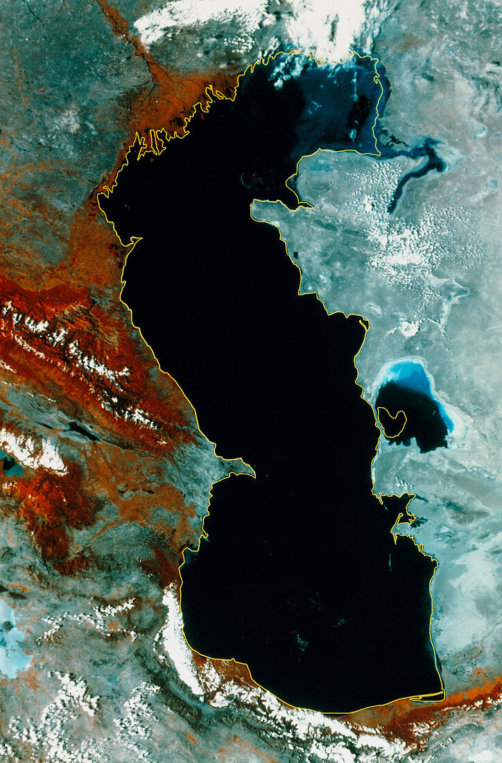
| Caspian Sea. Infrared satellite image of the Caspian Sea with a former shoreline overlaid as a yellow line. North is at top. In the infrared range deep water is black,shallow water is blue,bare ground is grey,green vegetation is red and clouds are white. The mouth of the Volga river is at top left. The Caspian Sea is the world's larg- est inland sea and loses water only by evapora- tion. It used to shrink because water from its feed rivers was used for irrigation but schemes to save water & redirect it to the Sea have lead an increase in size. Image taken in August 1993; the former shoreline is from August 1989 | |
| Licence : | Droits gérés |
| Crédit: | Science Photo Library / MDA Information Systems |
| Taille de l’image : | 3245 px × 4930 px |
| Model Release : | Non requis |
| Property Release : | Non requis |
| Restrictions : | - |
Prix pour cette image À partir de 45 €
Produit vendu
(Calendrier, Carte postale, Carte de vœux, Impression sur textile, Packaging etc)
À partir de 45 €
Usage commercial
(Affichage, Annonce presse, Annonce TV, Carte, Digital - hors rés. sociaux, Digital - rés. sociaux etc)
À partir de 45 €
Éditorial
(Digital, Journal, Livre, Livre pratique, Magazine, Télévision etc)
À partir de 60 €
Usage non-commercial
(Digital - hors rés. sociaux, Digital - rés. sociaux etc)
À partir de 120 €