River Plate estuary,Argentina
Numéro d’image : 11745113
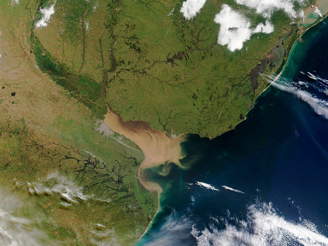
| River Plate estuary. Satellite image showing sedimentation (brown) in the River Plate (Rio de la Plata),which feeds into the Atlantic Ocean (far right). North is at top. Vegetation is green,water is blue,settlements are grey and clouds are white. The river forms a natural border between Argentina to the west and Uruguay to the north-east. The capital cities of both countries are situated on the river's shores,Argentina's Buenos Aires (centre left) & Uruguay's Montevideo (centre). Photographed on 3 April 2002 by the Moderate Resolution Imaging Spectroradiometer (MODIS),on board NASA's Terra satellite | |
| Licence : | Droits gérés |
| Crédit: | Science Photo Library / NASA |
| Taille de l’image : | 4000 px × 3000 px |
| Model Release : | Non requis |
| Property Release : | Non requis |
| Restrictions : | - |
Prix pour cette image À partir de 45 €
Produit vendu
(Calendrier, Carte postale, Carte de vœux, Impression sur textile, Packaging etc)
À partir de 45 €
Usage commercial
(Affichage, Annonce presse, Annonce TV, Carte, Digital - hors rés. sociaux, Digital - rés. sociaux etc)
À partir de 45 €
Éditorial
(Digital, Journal, Livre, Livre pratique, Magazine, Télévision etc)
À partir de 60 €
Usage non-commercial
(Digital - hors rés. sociaux, Digital - rés. sociaux etc)
À partir de 120 €
Mots clés
- 2002,
- américain,
- Amérique du Sud,
- argentin,
- Argentine,
- avril,
- BUENOS AIRES,
- de l'espace,
- environnement,
- environnemental,
- géographie,
- géographique,
- image satellite,
- imagerie,
- imaging spectroradiometer,
- modis,
- pont-jetée,
- résolution modérée,
- Rio de la Plata,
- rivière,
- rivières,
- sédiment,
- terra,
- terre,
- Uruguay,
- ville,
- voie d'eau