Ganges Delta
Numéro d’image : 11745109
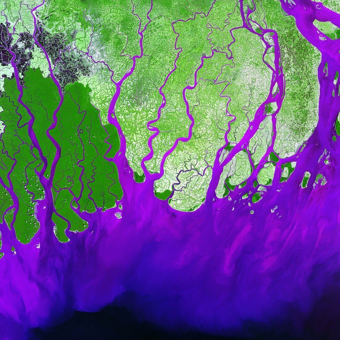
| Ganges Delta. Coloured satellite image of the delta of the Ganges River,Bangladesh,which runs into the Bay of Bengal (bottom). North at top. Swamp forest (known as Sunderbans) is light green,vegetation is dark green,urban areas are grey and sediment is purple. A delta is formed from the deposition of sediment at the mouth of a river. Deltas may be transitory and new channels are constantly forming while others become blocked. Over 120 million people live on the Ganges Delta,under the constant threat of floods. Image taken on 28 February 2000 by the Enhanced Thematic Mapper Plus sensor (ETM+) on board NASA's Landsat 7 satellite | |
| Licence : | Droits gérés |
| Crédit: | Science Photo Library / NASA |
| Taille de l’image : | 4000 px × 4000 px |
| Model Release : | Non requis |
| Property Release : | Non requis |
| Restrictions : | - |
Prix pour cette image À partir de 45 €
Produit vendu
(Calendrier, Carte postale, Carte de vœux, Impression sur textile, Packaging etc)
À partir de 45 €
Usage commercial
(Affichage, Annonce presse, Annonce TV, Carte, Digital - hors rés. sociaux, Digital - rés. sociaux etc)
À partir de 45 €
Éditorial
(Digital, Journal, Livre, Livre pratique, Magazine, Télévision etc)
À partir de 60 €
Usage non-commercial
(Digital - hors rés. sociaux, Digital - rés. sociaux etc)
À partir de 120 €
Mots clés
- 2000,
- appareil de cartographie thématique amélioré,
- Asie,
- baie,
- Bangladesh,
- Bengale,
- coloré,
- colorié,
- colorisé,
- de l'espace,
- delta du Gange,
- Enhanced Thematic Mapper Plus,
- environnement,
- ETM+,
- février,
- géographie,
- image satellite,
- imagerie,
- inondation,
- landsat 7,
- NASA,
- niveau de la mer,
- pont-jetée,
- rivière,
- rivières,
- sédiment,
- voie d'eau