Zeeland and the Rhine and Schelde estuaries
Numéro d’image : 11745089
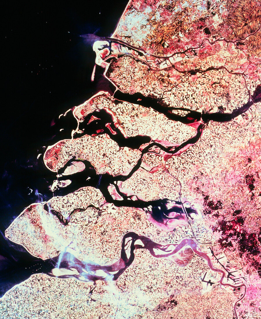
| Zeeland,seen from space. Satellite image of Zeeland,the island complex formed at estuaries of the Rhine and Schelde rivers. The Rhine is the widest river at top. Just to the north of the Rhine is the city of Rotterdam and its vast system of docks. In the bottom right corner is Antwerp,sitting on the River Schelde and posessing its own dock system. A large canal (dark line) cuts across many of the islands and peninsulas to link the two cities. The land in most of the image is in the Netherlands; Antwerp is in the far north of Belgium. The data for this image were gathered by a Landsat satellite | |
| Licence : | Droits gérés |
| Crédit: | Science Photo Library / Geospace |
| Taille de l’image : | 3015 px × 3691 px |
| Model Release : | Non requis |
| Property Release : | Non requis |
| Restrictions : | - |
Prix pour cette image À partir de 45 €
Produit vendu
(Calendrier, Carte postale, Carte de vœux, Impression sur textile, Packaging etc)
À partir de 45 €
Usage commercial
(Affichage, Annonce presse, Annonce TV, Carte, Digital - hors rés. sociaux, Digital - rés. sociaux etc)
À partir de 45 €
Éditorial
(Digital, Journal, Livre, Livre pratique, Magazine, Télévision etc)
À partir de 60 €
Usage non-commercial
(Digital - hors rés. sociaux, Digital - rés. sociaux etc)
À partir de 120 €