Landsat photo of the Ganges Delta,Bangladesh
Numéro d’image : 11745079
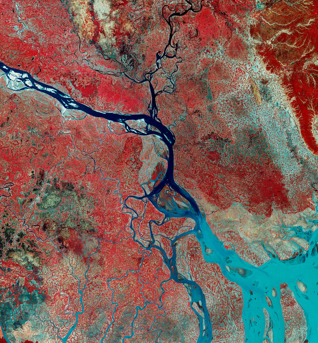
| Landsat image of the Ganges delta,Bangladesh. The image was recorded in February,at the end of the dry season. North is to the top. The red areas are dry-season crops,almost ready to harvest; to the south,the pale blue areas dotted with red are regions being prepared for rice planting; to the southwest,the greenish areas are infertile swamp land. The River Ganges flows from India to the west; the river that joins it from the north is the Brahmaputra. The Ganges Delta changes shape from year to year; the blue tone at the river mouth is due to the huge volumes of sediment being carried into the Bay of Bengal | |
| Licence : | Droits gérés |
| Crédit: | Science Photo Library / MDA Information Systems |
| Taille de l’image : | 4050 px × 4366 px |
| Model Release : | Non requis |
| Property Release : | Non requis |
| Restrictions : | - |
Prix pour cette image À partir de 45 €
Produit vendu
(Calendrier, Carte postale, Carte de vœux, Impression sur textile, Packaging etc)
À partir de 45 €
Usage commercial
(Affichage, Annonce presse, Annonce TV, Carte, Digital - hors rés. sociaux, Digital - rés. sociaux etc)
À partir de 45 €
Éditorial
(Digital, Journal, Livre, Livre pratique, Magazine, Télévision etc)
À partir de 60 €
Usage non-commercial
(Digital - hors rés. sociaux, Digital - rés. sociaux etc)
À partir de 120 €