Victoria Falls
Numéro d’image : 11745036
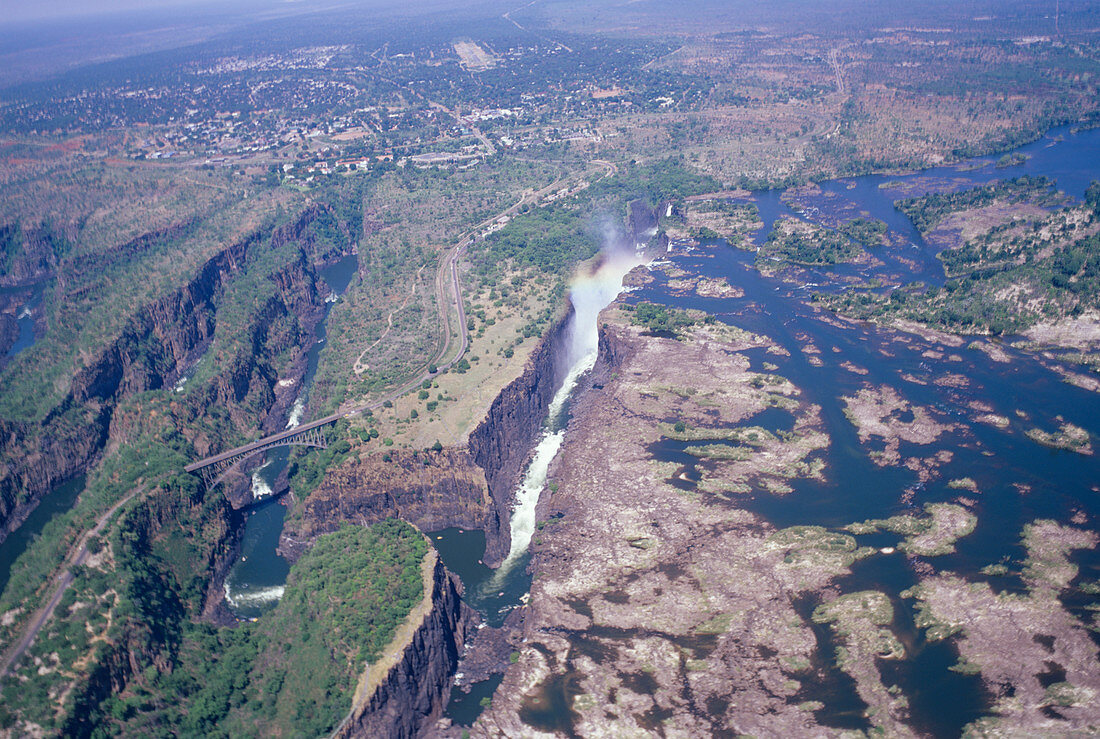
| Victoria Falls,Zimbabwe,aerial photograph. This view looks west along the entire 1700-metre-long lip of the waterfall. The waterfall is formed as the Zambezi River (flowing from right) falls into a 100-metre-deep chasm. In the dry season,most of the water flows over the western (further) part of the waterfall,while the eastern (nearer) side is mostly dry. The chasm is a crack in the rock that was widened by the river. After falling over the waterfall,the river flows through the zig-zag of earlier chasms at left. The river runs along the border between Zimbabwe (upper frame) and Zambia (lower frame). The Victoria Falls Bridge (built in 1905) is at lower left | |
| Licence : | Droits gérés |
| Crédit: | Science Photo Library / Dominguez, Carlos |
| Taille de l’image : | 5121 px × 3440 px |
| Model Release : | Non requis |
| Property Release : | Non requis |
| Restrictions : | - |
Prix pour cette image À partir de 45 €
Produit vendu
(Calendrier, Carte postale, Carte de vœux, Impression sur textile, Packaging etc)
À partir de 45 €
Usage commercial
(Affichage, Annonce presse, Annonce TV, Carte, Digital - hors rés. sociaux, Digital - rés. sociaux etc)
À partir de 45 €
Éditorial
(Digital, Journal, Livre, Livre pratique, Magazine, Télévision etc)
À partir de 60 €
Usage non-commercial
(Digital - hors rés. sociaux, Digital - rés. sociaux etc)
À partir de 120 €