Amazon rivers
Numéro d’image : 11744891
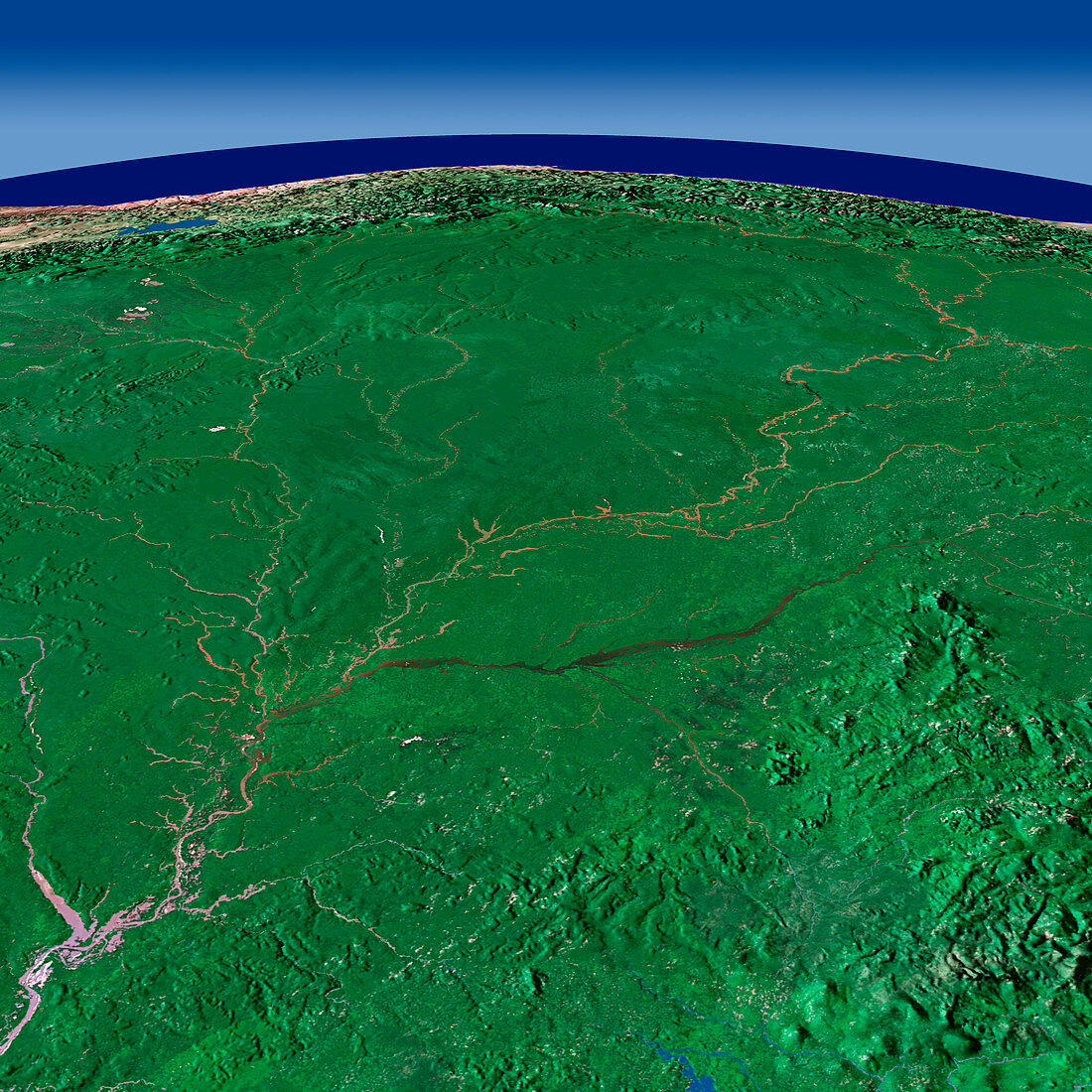
| Amazon rivers,satellite image. North is at right. The city of Manaus (grey,bottom left corner),situated in north-west Brazil,is the capital of the state of Amazonas. The Pacific Ocean (dark blue,across top) lies beyond the Andes mountain chain (brown) and the countries of Ecuador (upper left) and Colombia (upper centre). The Pacaraima Mountains,which comprise part of Guiana's High- lands (mountainous plateau) are at lower right. The region is a natural boarder between Venezuela to the west,Guiana to the east and Brazil | |
| Licence : | Droits gérés |
| Crédit: | Science Photo Library / Worldsat International |
| Taille de l’image : | 6000 px × 6000 px |
| Model Release : | Non requis |
| Property Release : | Non requis |
| Restrictions : |
|
Prix pour cette image À partir de 45 €
Produit vendu
(Calendrier, Carte postale, Carte de vœux, Impression sur textile, Packaging etc)
À partir de 45 €
Usage commercial
(Affichage, Annonce presse, Annonce TV, Carte, Digital - hors rés. sociaux, Digital - rés. sociaux etc)
À partir de 45 €
Éditorial
(Digital, Journal, Livre, Livre pratique, Magazine, Télévision etc)
À partir de 60 €
Usage non-commercial
(Digital - hors rés. sociaux, Digital - rés. sociaux etc)
À partir de 120 €
Mots clés
- affluent,
- Amazone,
- Amazonie,
- américain,
- Amérique du Sud,
- boisé,
- Brésil,
- brésilien,
- chaîne de montagne,
- chaîne montagneuse,
- Colombie,
- environnement,
- environnemental,
- Equateur,
- forêt,
- forêt tropicale,
- gamme,
- géographie,
- géographique,
- jungle,
- Les Andes,
- Océan Pacifique,
- Pérou,
- satellite,
- terre vue de l'espace,
- tributaires,
- Venezuela