Xingu River
Numéro d’image : 11744889
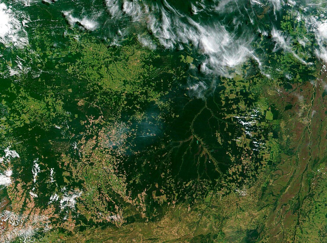
| Xingu River. Satellite image of the Xingu river in Amazonia,Brazil. North is at top. Forest is dark green and marshland is black. The river flows from top centre to lower centre. The geometric patterns (brown & light green) are farms and settlements built following deforestation of the area. Photographed on 5 February 2001 by the Moderate Resolution Imaging Spectroradiometer (MODIS) aboard NASA's Terra satellite | |
| Licence : | Droits gérés |
| Crédit: | Science Photo Library / NASA |
| Taille de l’image : | 3500 px × 2600 px |
| Model Release : | Non requis |
| Property Release : | Non requis |
| Restrictions : | - |
Prix pour cette image À partir de 45 €
Produit vendu
(Calendrier, Carte postale, Carte de vœux, Impression sur textile, Packaging etc)
À partir de 45 €
Usage commercial
(Affichage, Annonce presse, Annonce TV, Carte, Digital - hors rés. sociaux, Digital - rés. sociaux etc)
À partir de 45 €
Éditorial
(Digital, Journal, Livre, Livre pratique, Magazine, Télévision etc)
À partir de 60 €
Usage non-commercial
(Digital - hors rés. sociaux, Digital - rés. sociaux etc)
À partir de 120 €
Mots clés
- 2001,
- affluent,
- agriculture,
- Amazone,
- Amazonie,
- américain,
- Amérique du Sud,
- boisé,
- Brésil,
- brésilien,
- champs,
- de l'espace,
- déforestation,
- environnement,
- environnemental,
- février,
- forêt,
- forêt tropicale,
- géographie,
- géographique,
- image de moyenne résolution,
- jungle,
- marais,
- marécage,
- marécages,
- milieux humides,
- modis,
- NASA,
- optique,
- rivière,
- spectroradiomètre,
- Terra,
- terre humide,
- tributaires,
- vraie couleur,
- Xingu,
- zone humide,
- zones humides