Landsat photo of River Nile
Numéro d’image : 11744842
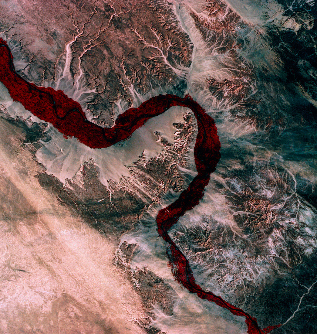
| Landsat photograph of the River Nile as it snakes past Luxor (grey area on right bank,one third of the way up the image). The major features are the dense bands of cultivation which cling to the banks of the river through a highly-developed irrigation system,assisted by the Aswan Dam which curbed the spring floods. The loop in the centre of the river contains the Valley of the Kings. But drifting sands have concealed many of the structures of Ancient Egypt | |
| Licence : | Droits gérés |
| Crédit: | Science Photo Library / MDA Information Systems |
| Taille de l’image : | 3247 px × 3418 px |
| Model Release : | Non requis |
| Property Release : | Non requis |
| Restrictions : | - |
Prix pour cette image À partir de 45 €
Produit vendu
(Calendrier, Carte postale, Carte de vœux, Impression sur textile, Packaging etc)
À partir de 45 €
Usage commercial
(Affichage, Annonce presse, Annonce TV, Carte, Digital - hors rés. sociaux, Digital - rés. sociaux etc)
À partir de 45 €
Éditorial
(Digital, Journal, Livre, Livre pratique, Magazine, Télévision etc)
À partir de 60 €
Usage non-commercial
(Digital - hors rés. sociaux, Digital - rés. sociaux etc)
À partir de 120 €