Himalayas mountains
Numéro d’image : 11744670
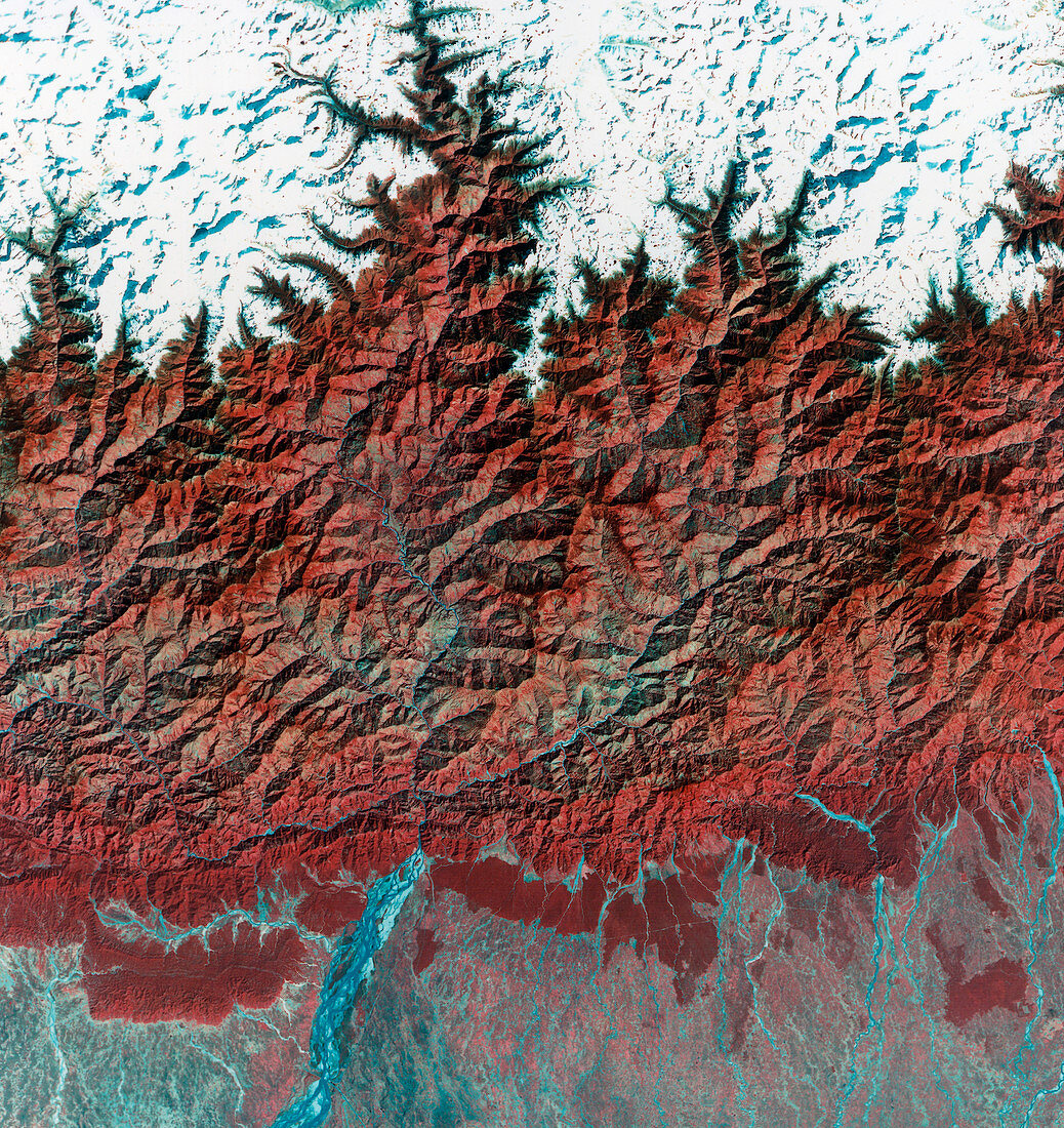
| Himalayas. Combined infrared and optical satellite image of the Himalaya mountain range on the Tibet- Nepal border. North is at top. Mount Everest is at upper right. At 8848 metres,this is the tallest mountain on Earth. Across lower frame are numerous tributaries of the Ganges river,fed by melting snow from the mountain range. The image is 186 kilometres wide. Taken by the Landsat 1 satellite on 7th November 1972 | |
| Licence : | Droits gérés |
| Crédit: | Science Photo Library / MDA Information Systems |
| Taille de l’image : | 4193 px × 4444 px |
| Model Release : | Non requis |
| Property Release : | Non requis |
| Restrictions : | - |
Prix pour cette image À partir de 45 €
Produit vendu
(Calendrier, Carte postale, Carte de vœux, Impression sur textile, Packaging etc)
À partir de 45 €
Usage commercial
(Affichage, Annonce presse, Annonce TV, Carte, Digital - hors rés. sociaux, Digital - rés. sociaux etc)
À partir de 45 €
Éditorial
(Digital, Journal, Livre, Livre pratique, Magazine, Télévision etc)
À partir de 60 €
Usage non-commercial
(Digital - hors rés. sociaux, Digital - rés. sociaux etc)
À partir de 120 €