Coloured radar image of mountains in Tibet
Numéro d’image : 11744651
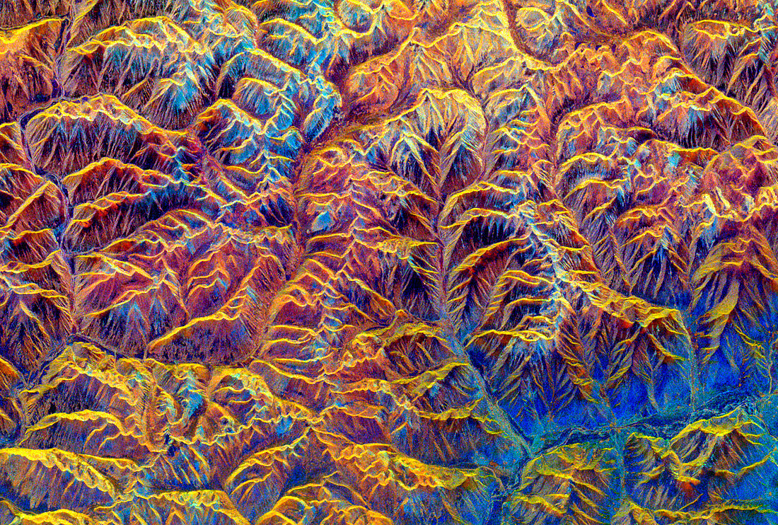
| Tibetan mountains. Coloured Spaceborne Imaging Radar (SIR) image of mountains in southeast Tibet. North is at top. This area of the Tibetan Plateau is about 90 km east of the city of Lhasa. The valley at bottom right contains the river Lhasa He which runs into the Brahmaputra. Here,even the valleys are 4300 metres above sea level. The rough terrain reflects the recent erosion of this area by water. Granite rock is orange and brown,while older sedimentary and volcanic rock is blue. The image was taken on April 10 1994 by the SIR-C/X- SAR (X-band Synthetic Aperture Radar) carried on a space shuttle mission. Image area: 50x34 km | |
| Licence : | Droits gérés |
| Crédit: | Science Photo Library / NASA / JPL |
| Taille de l’image : | 1990 px × 1342 px |
| Model Release : | Non requis |
| Property Release : | Non requis |
| Restrictions : | - |
Prix pour cette image À partir de 45 €
Produit vendu
(Calendrier, Carte postale, Carte de vœux, Impression sur textile, Packaging etc)
À partir de 45 €
Usage commercial
(Affichage, Annonce presse, Annonce TV, Carte, Digital - hors rés. sociaux, Digital - rés. sociaux etc)
À partir de 45 €
Éditorial
(Digital, Journal, Livre, Livre pratique, Magazine, Télévision etc)
À partir de 60 €
Usage non-commercial
(Digital - hors rés. sociaux, Digital - rés. sociaux etc)
À partir de 120 €