Coloured radar satellite image of central Alps
Numéro d’image : 11744644
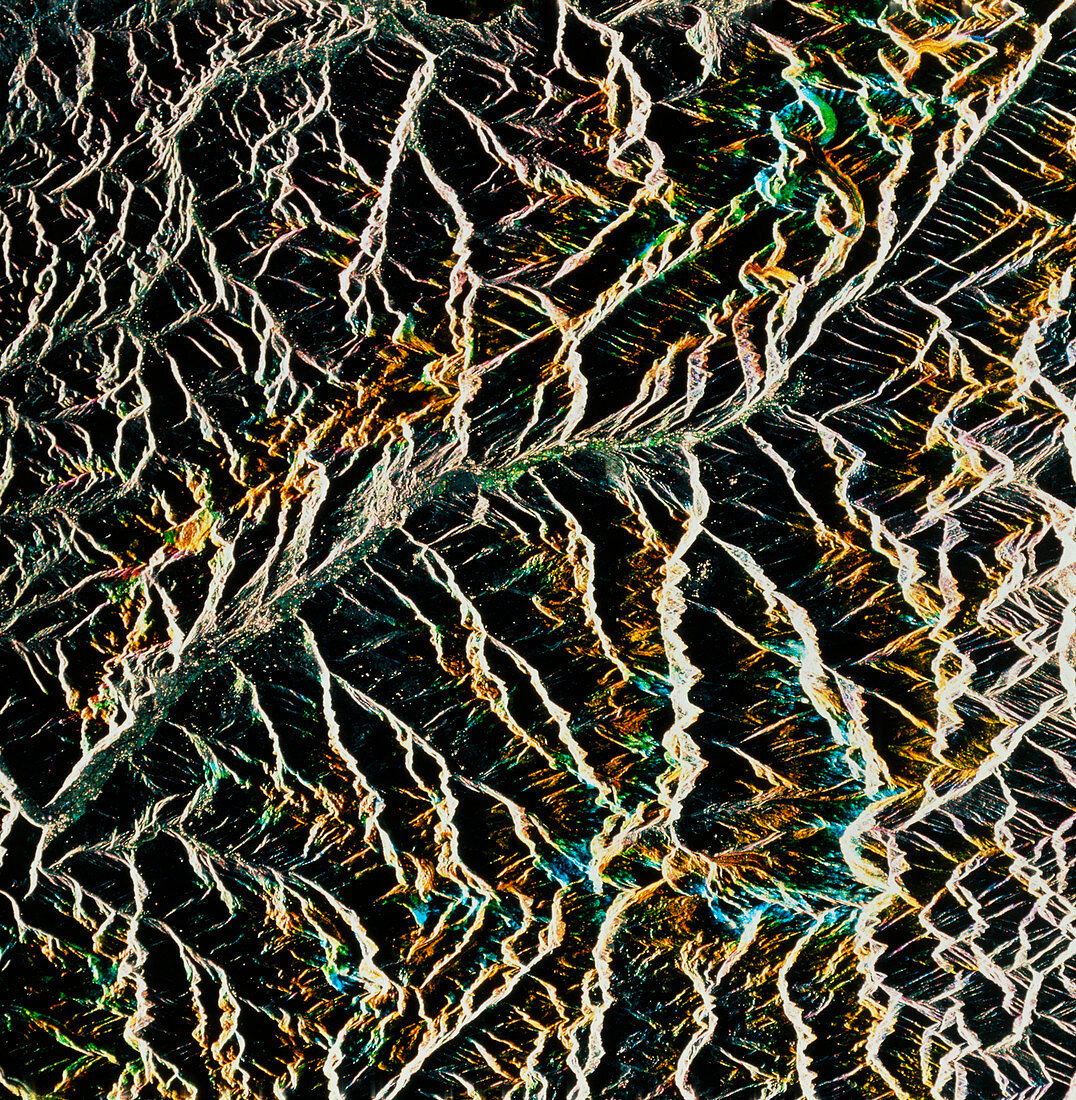
| Central Alps. Coloured radar satellite image of the central Alps. North is towards the top. The curving line running from northeast to southwest is the Rhone Valley. The thin black line in the valley is the River Rhone. This image was made by combining three frames taken at different dates. Coloured areas represent changes in the appearance of the land between the dates,while unchanged areas appear white or black. The strong white and black markings are caused by reflection of radar from mountain slopes. Image produced by European Radar Satellite 1. The area shown is approximately 100km x 100km | |
| Licence : | Droits gérés |
| Crédit: | Science Photo Library / ESA, EURIMAGE |
| Taille de l’image : | 4160 px × 4252 px |
| Model Release : | Non requis |
| Property Release : | Non requis |
| Restrictions : |
|
Prix pour cette image À partir de 45 €
Produit vendu
(Calendrier, Carte postale, Carte de vœux, Impression sur textile, Packaging etc)
À partir de 45 €
Usage commercial
(Affichage, Annonce presse, Annonce TV, Carte, Digital - hors rés. sociaux, Digital - rés. sociaux etc)
À partir de 45 €
Éditorial
(Digital, Journal, Livre, Livre pratique, Magazine, Télévision etc)
À partir de 60 €
Usage non-commercial
(Digital - hors rés. sociaux, Digital - rés. sociaux etc)
À partir de 120 €