Geology aroung Yangtze River,China
Numéro d’image : 11744598
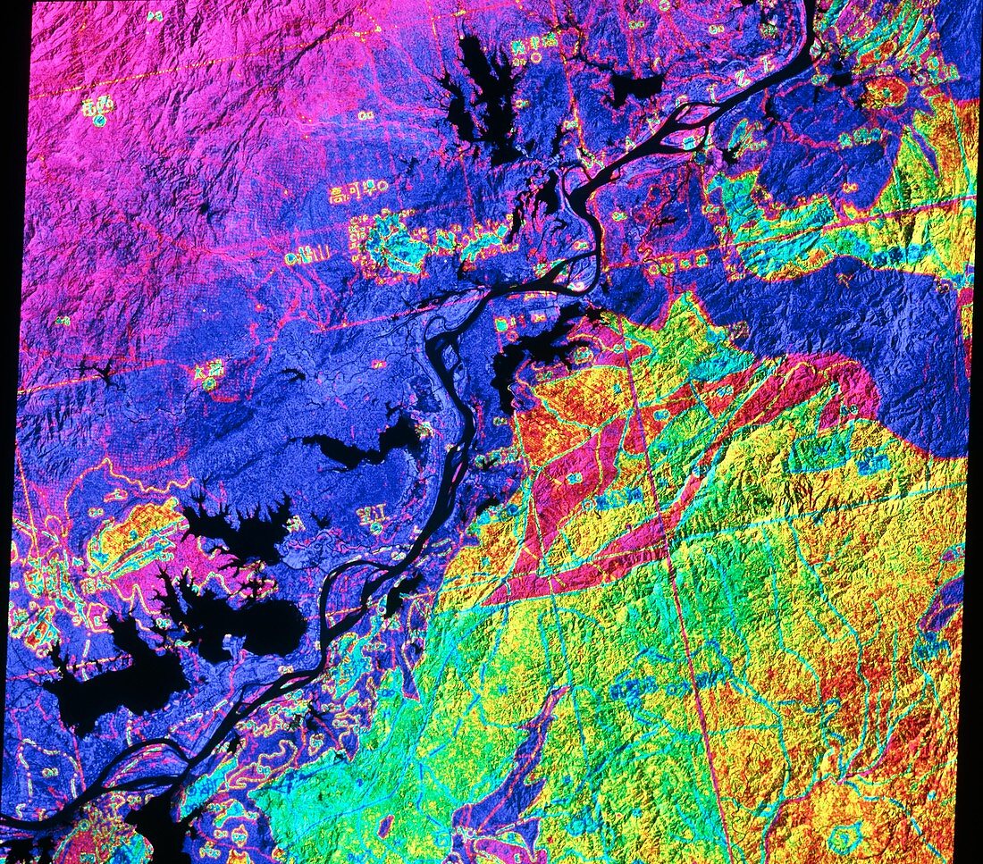
| Geology map of part of China. False-coloured satellite image showing part of Anhui Province,China. Colours have been laid on top of a monochrome satellite image to indicate the complex surface geology of the region. The dark diagonal line is part of the Chang Jiang (Yangtze) River. Large black areas are lakes. This sort of map is used in a variety of remote sensing applications such as petroleum and mineral prospecting. The data for this image were gathered by a Landsat satellite | |
| Licence : | Droits gérés |
| Crédit: | Science Photo Library / NRSC / BP |
| Taille de l’image : | 4621 px × 4064 px |
| Model Release : | Non requis |
| Property Release : | Non requis |
| Restrictions : | - |
Prix pour cette image À partir de 45 €
Produit vendu
(Calendrier, Carte postale, Carte de vœux, Impression sur textile, Packaging etc)
À partir de 45 €
Usage commercial
(Affichage, Annonce presse, Annonce TV, Carte, Digital - hors rés. sociaux, Digital - rés. sociaux etc)
À partir de 45 €
Éditorial
(Digital, Journal, Livre, Livre pratique, Magazine, Télévision etc)
À partir de 60 €
Usage non-commercial
(Digital - hors rés. sociaux, Digital - rés. sociaux etc)
À partir de 120 €