Nevada high desert from space
Numéro d’image : 11744594
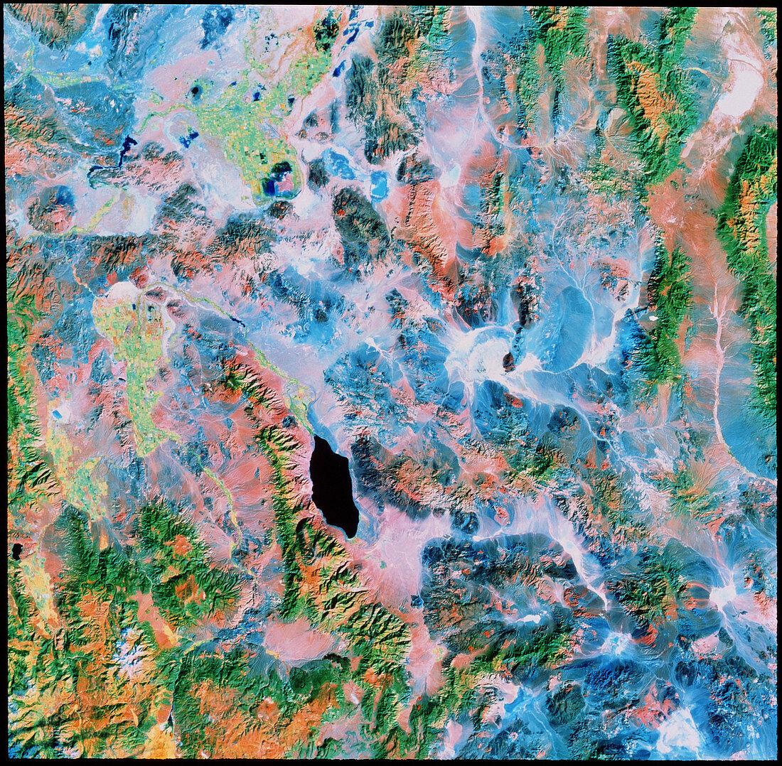
| False-colour infrared image of part of Nevada,USA,showing types of land cover. At bottom left are the mountains of the Sierra Nevada. Three pale green patches at centre and upper left are irrigated agricultural field systems. The black feature just below centre is Walker Lake; to the left of this is the Wassuk Range,and to the right is the Gabbs Valley Range that arcs toward bottom right. Below Gabbs Valley is the circular upland of the Excelsior Mountains. Pale blue colours indicate cover by silicate sands and salts. The data for this image were gathered by a Landsat satellite on 20 October 1987 | |
| Licence : | Droits gérés |
| Crédit: | Science Photo Library / MDA Information Systems |
| Taille de l’image : | 3772 px × 3697 px |
| Model Release : | Non requis |
| Property Release : | Non requis |
| Restrictions : | - |
Prix pour cette image À partir de 45 €
Produit vendu
(Calendrier, Carte postale, Carte de vœux, Impression sur textile, Packaging etc)
À partir de 45 €
Usage commercial
(Affichage, Annonce presse, Annonce TV, Carte, Digital - hors rés. sociaux, Digital - rés. sociaux etc)
À partir de 45 €
Éditorial
(Digital, Journal, Livre, Livre pratique, Magazine, Télévision etc)
À partir de 60 €
Usage non-commercial
(Digital - hors rés. sociaux, Digital - rés. sociaux etc)
À partir de 120 €