Mount Ruapehu volcano,New Zealand
Numéro d’image : 11740770
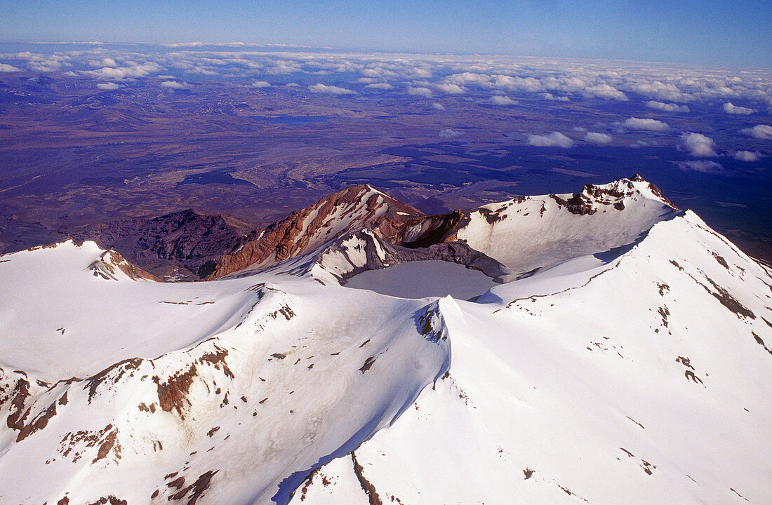
| Mount Ruapehu volcano. Aerial photograph of the crater lake and glaciers on the summit of Mount Ruapehu,a volcano on New Zealand's North Island. There are several peaks on Mount Ruapehu. This peak is Tahurangi (2797 metres),and is the highest point on the North Island. Mount Ruapehu lies at the southern end of the Taupo volcanic zone. The volcano has erupted 10 times in the 20th century,including eruptions from 1995-7. One of the major dangers of this volcano is the collapse of the dams forming this crater lake,which has in the past caused catastrophic mud flows (lahars) | |
| Licence : | Droits gérés |
| Crédit: | Science Photo Library / Alean, Dr. Juerg |
| Taille de l’image : | 5146 px × 3369 px |
| Model Release : | Non requis |
| Property Release : | Non requis |
| Restrictions : | - |
Prix pour cette image À partir de 45 €
Produit vendu
(Calendrier, Carte postale, Carte de vœux, Impression sur textile, Packaging etc)
À partir de 45 €
Usage commercial
(Affichage, Annonce presse, Annonce TV, Carte, Digital - hors rés. sociaux, Digital - rés. sociaux etc)
À partir de 45 €
Éditorial
(Digital, Journal, Livre, Livre pratique, Magazine, Télévision etc)
À partir de 60 €
Usage non-commercial
(Digital - hors rés. sociaux, Digital - rés. sociaux etc)
À partir de 120 €
Mots clés
- actif,
- caldera,
- cratère volcanique,
- crête,
- géographie physique,
- géologie,
- géologique,
- horizon,
- Ile du Nord,
- lac,
- montagne,
- nature,
- neige,
- Nouvelle Zélande,
- Nouvelle-Zélande,
- oceania,
- Océanie,
- paysage,
- photo aérienne,
- photographie aérienne,
- pic,
- pointe,
- scène,
- scénique,
- science de la terre,
- sommet,
- Taupo,
- volcan,
- volcanique,
- vulcanologie