3D radar reconstruction of Kilauea volcano
Numéro d’image : 11740567
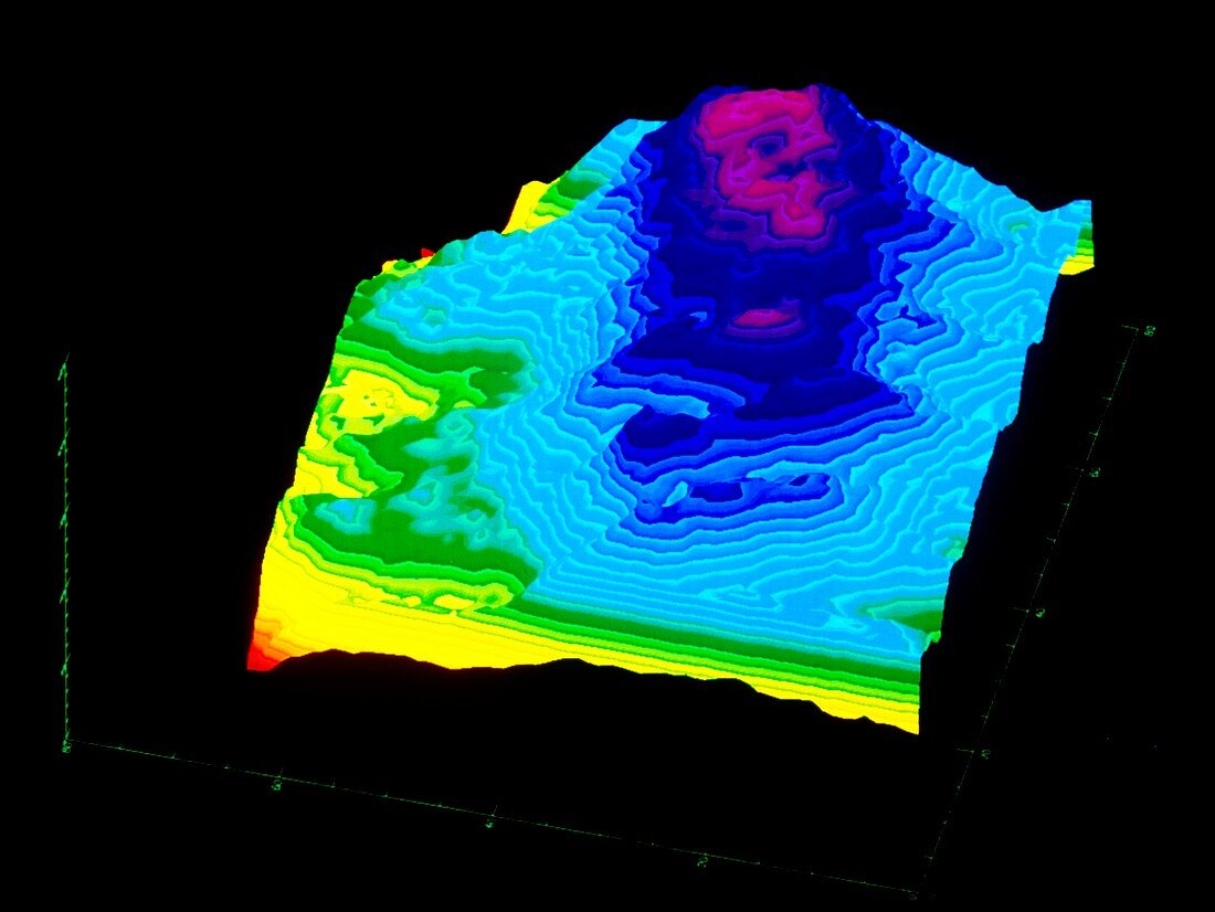
| Kilauea volcano. Three dimensional perspective view of Kilauea volcano,derived from radar interferometry. The colours represent height,with contours spaced at 20 metre intervals. The area covered by this image is about 4 kilometres wide by 12 kilometres deep,with an overall altitude range of 500 metres. The data for this image were derived from the interferometric combination of two X-band Synthetic Aperture Radar (X-SAR) images; the first taken on 13 April 1994 during Shuttle Mission STS-59,the second on 4 October 1994 during Shuttle Mission STS-68. X-SAR is part of the Shuttle Imaging Radar SIR-C package carried on both of the above missions | |
| Licence : | Droits gérés |
| Crédit: | Science Photo Library / NASA |
| Taille de l’image : | 4873 px × 3661 px |
| Model Release : | Non requis |
| Property Release : | Non requis |
| Restrictions : | - |
Prix pour cette image À partir de 45 €
Produit vendu
(Calendrier, Carte postale, Carte de vœux, Impression sur textile, Packaging etc)
À partir de 45 €
Usage commercial
(Affichage, Annonce presse, Annonce TV, Carte, Digital - hors rés. sociaux, Digital - rés. sociaux etc)
À partir de 45 €
Éditorial
(Digital, Journal, Livre, Livre pratique, Magazine, Télévision etc)
À partir de 60 €
Usage non-commercial
(Digital - hors rés. sociaux, Digital - rés. sociaux etc)
À partir de 120 €