Nimbus-7 TOMS SO2 post El Chichon eruption 5/4/82
Numéro d’image : 11740528
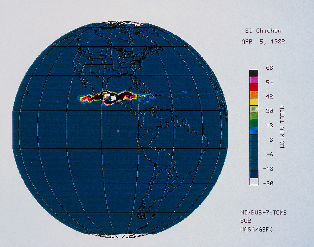
| Satellite image of atmospheric sulphur dioxide (SO2) after the eruption of El Chichon,Yucatan,Mexico. El Chichon erupted on 28 March 1982 & again on the 3rd & 4th of April. This image,the 2nd in a series of 4,relates to data obtained on April 5th by the Total Ozone Mapping Spectrometer (TOMS) on the Nimbus-7 satellite,an instrument normally dedicated to measuring atmospheric ozone. The colour scale at right shows concentration of SO2,with black representing the highest levels. This image shows the SO2 plume's increasing east- west spread; successive images show its enlargement & ultimate dispersal | |
| Licence : | Droits gérés |
| Crédit: | Science Photo Library / GSFC / NASA / LABORATORY FOR ATMOSPHERES |
| Taille de l’image : | 3570 px × 2807 px |
| Model Release : | Non requis |
| Property Release : | Non requis |
| Restrictions : | - |
Prix pour cette image À partir de 45 €
Produit vendu
(Calendrier, Carte postale, Carte de vœux, Impression sur textile, Packaging etc)
À partir de 45 €
Usage commercial
(Affichage, Annonce presse, Annonce TV, Carte, Digital - hors rés. sociaux, Digital - rés. sociaux etc)
À partir de 45 €
Éditorial
(Digital, Journal, Livre, Livre pratique, Magazine, Télévision etc)
À partir de 60 €
Usage non-commercial
(Digital - hors rés. sociaux, Digital - rés. sociaux etc)
À partir de 120 €