San Andreas fault
Numéro d’image : 11740382
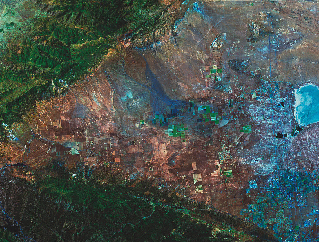
| San Andreas fault. True-colour satellite image of part of the San Andreas fault,California,USA. North is at top. Vegetation is green and arid areas are brown. Two fault zones are marked by two mountain ranges forming a V-shape and meeting at far left. The San Andreas fault runs across the bottom of the image,while the Garlock fault runs across the upper left corner. Rectangular-shaped fields (some green) are seen in the area between the mountains. The dry bed of Rosamond Lake (blue) is seen at far right. The San Andreas fault extends almost the full length of California,and causes major earthquakes in the region | |
| Licence : | Droits gérés |
| Crédit: | Science Photo Library / MDA Information Systems |
| Taille de l’image : | 4305 px × 3272 px |
| Model Release : | Non requis |
| Property Release : | Non requis |
| Restrictions : | - |
Prix pour cette image À partir de 45 €
Produit vendu
(Calendrier, Carte postale, Carte de vœux, Impression sur textile, Packaging etc)
À partir de 45 €
Usage commercial
(Affichage, Annonce presse, Annonce TV, Carte, Digital - hors rés. sociaux, Digital - rés. sociaux etc)
À partir de 45 €
Éditorial
(Digital, Journal, Livre, Livre pratique, Magazine, Télévision etc)
À partir de 60 €
Usage non-commercial
(Digital - hors rés. sociaux, Digital - rés. sociaux etc)
À partir de 120 €
Mots clés
- agriculture,
- américain,
- Amérique,
- Californie,
- champ,
- champs,
- cultivé,
- défauts,
- dislocation,
- Etats-Unis,
- faille,
- faille sismique,
- fautes,
- frontière,
- géographie,
- géologie,
- géologique,
- image satellite,
- imagerie satellitaire,
- imagerie satellite,
- L.A.,
- LA,
- limite,
- Los Angeles,
- marge,
- mer,
- montagnes,
- plaques,
- plats,
- san andreas,
- sismologie,
- tectonique,
- terre,
- tremblement de terre,
- urbain,
- USA,
- ville