San Andreas fault
Numéro d’image : 11740380
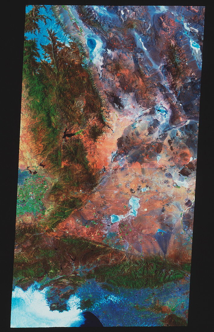
| San Andreas fault. True-colour satellite image of part of the San Andreas fault,California,USA. North is at top. Vegetation is green and arid areas are brown. Two fault zones are seen as lines formed by the contrast between such brown and green areas. The San Andreas fault runs across the bottom of the image,while the Garlock fault meets it at lower left,forming a V-shape. The city of Los Angeles is the grey-blue area (bottom right) on the Pacific coast. Clouds (white) are at bottom left. The San Andreas fault extends most of the length of California,causing major earthquakes in the region. Photographed on 15 June 1996 | |
| Licence : | Droits gérés |
| Crédit: | Science Photo Library / MDA Information Systems |
| Taille de l’image : | 3010 px × 4669 px |
| Model Release : | Non requis |
| Property Release : | Non requis |
| Restrictions : | - |
Prix pour cette image À partir de 45 €
Produit vendu
(Calendrier, Carte postale, Carte de vœux, Impression sur textile, Packaging etc)
À partir de 45 €
Usage commercial
(Affichage, Annonce presse, Annonce TV, Carte, Digital - hors rés. sociaux, Digital - rés. sociaux etc)
À partir de 45 €
Éditorial
(Digital, Journal, Livre, Livre pratique, Magazine, Télévision etc)
À partir de 60 €
Usage non-commercial
(Digital - hors rés. sociaux, Digital - rés. sociaux etc)
À partir de 120 €
Mots clés
- 1996,
- américain,
- Amérique,
- Californie,
- défauts,
- dislocation,
- Etats-Unis,
- faille,
- faille sismique,
- fautes,
- frontière,
- géographie,
- géologie,
- géologique,
- image satellite,
- imagerie satellitaire,
- imagerie satellite,
- L.A.,
- LA,
- limite,
- Los Angeles,
- marge,
- mer,
- montagnes,
- nord,
- pacifique,
- plaques,
- plats,
- san andreas,
- sismologie,
- tectonique,
- terre,
- tremblement de terre,
- urbain,
- USA,
- ville